
|
|
Route |
|---|---|
|
|
39.84800°N / 113.905°W |
|
|
Download GPX » View Route on Map |
|
|
Overview
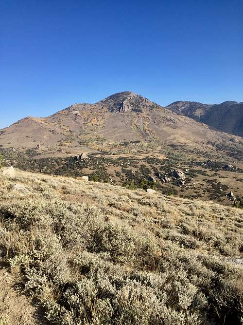
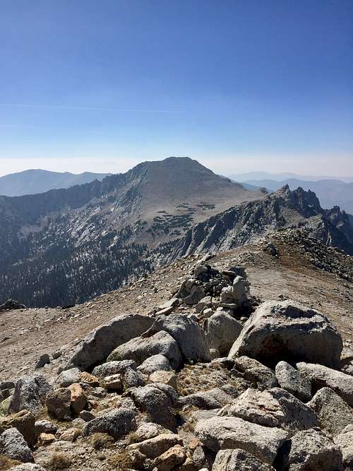
There seems to be two possible approaches to Haystack Peak: one from the south, via Granite Creek Canyon and Ibapah Peak; the other from the north, via Toms Creek Canyon. Scouring the internet reveals very little information about either. From Granite Creek, depending on where one parks, the hike could be in the 18-mile range, with over 7000 feet of gain, going over Ibapah Peak first and then negoatiating a class 4 knife-edge ridge to get to Haystack Peak. This route instead takes the northern approach, using a combination of an existing, old two-track and off-trail hiking to the crest of the Deep Creek range, summiting Ibepah Azimuth first, and then scrambling around a knife-edge ridge to Haystack Peak. The hike comes out to around 8 miles, 4300 feet of gain, and no more than class 3 scrambling for about a quarter mile to skirt the knife edge.
Getting There
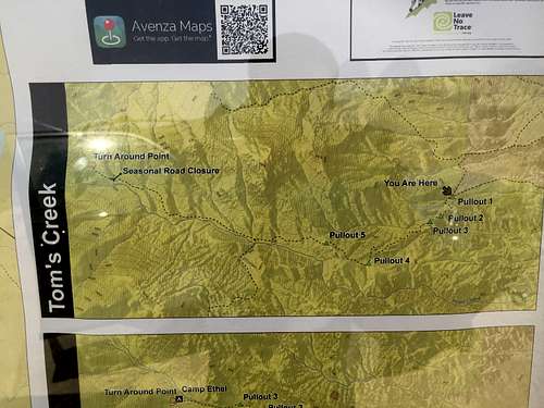
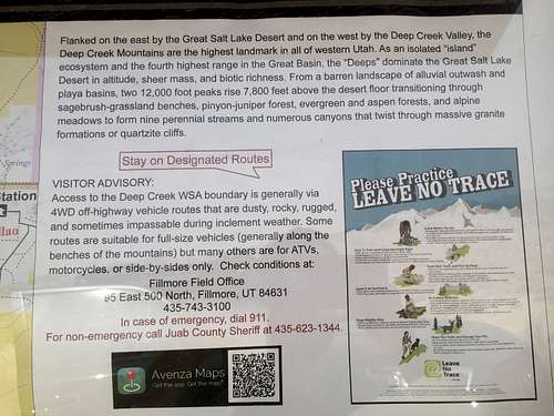
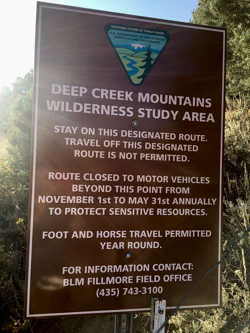
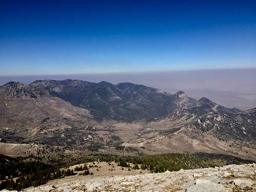
The first obstacle in getting to Haystack Peak is the drive itself. From Salt Lake City, head west on I-80 to Wendover, and then head south on US-93A. In about 26 miles, turn left onto Dead Cedar Road, alternatively called Ibapah Road. This road heads southeast and then south towards the town of Ibapah, Utah. After about 29 miles, turn left onto Lower Gold Hill Road, and stay on this road for 6 miles. Turn right onto a secton of the Pony Express historical driving route, where it will merge onto another section in a little over a mile. Keep straight, heading south for a little over 12 miles. Here, the road meets the Snake Valley road. Turn right, heading south and passing the town of Callao. After nearly 6 miles, turn left at the sign indicating Toms Creek. You will just pass an irrigation ditch. Head west on this road. In a little over 2 miles, you will come to an intersection with several other roads. Keep straight. In 1.7 miles, you will turn left, head down into a ravine, and back up to another bench. A half mile will bring you to an information board about the Deep Creek Wilderness Study Area.
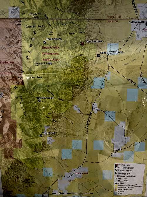
The next section is the roughest. This will require a 4WD, high-clearance vehicle. The road is very steep, and has a few significant rocky bumps that a low-clearance vehicle will have trouble negotiating. Once the road starts to head down into the Toms Creek drainage, the grade lessens and the road is much smoother. There are a couple of good places to camp along the road near old miners' cabins.
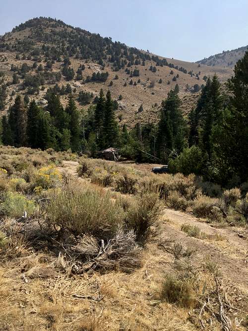
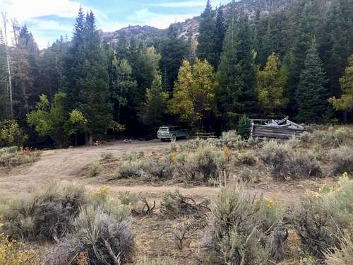
The road ends where the BLM has built a fence about 5 miles from the information board. The trail starts a few hundred feet down from the end of the road at cattle gate near a grove of pine trees.
Route Description
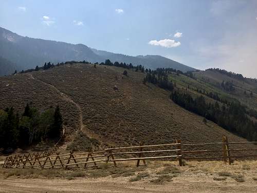
The first part of the hike uses an old two-track that works its way above Toms Creek. From the cattle gate, the two-track heads south and then west uphill. After about .75 mile, the two-track heads northwest for a little over a mile while gaining little elevation.
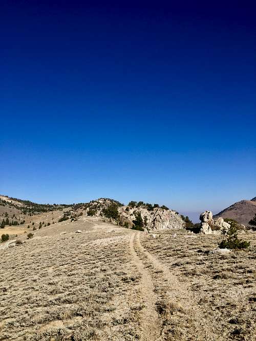
The two-track meets the edge of the crest near a saddle with nearby Rocky Peak and then abruptly turns south-southwest, following the ridge crest.

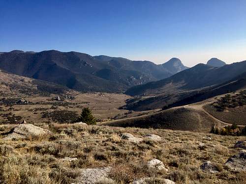
After about 2.9 miles from the start, the two-track ends, and the routfinding begins. Simply follow the ridge, generally staying to the left/east of the granite outcroppings along the way. You may find some pack trails that help. At 4.4 miles, the mix of forest, rock outcroppings, and sagebrush/grasslands you've been hiking through ends, and the slope up Ibepah Azimuth begins.
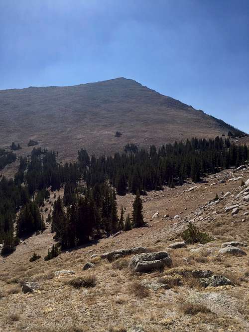
The ground is mostly small boulders and grasses. To reach Haystack Peak from Ibepah Azimuth, the best way is to head west around the knife edge.
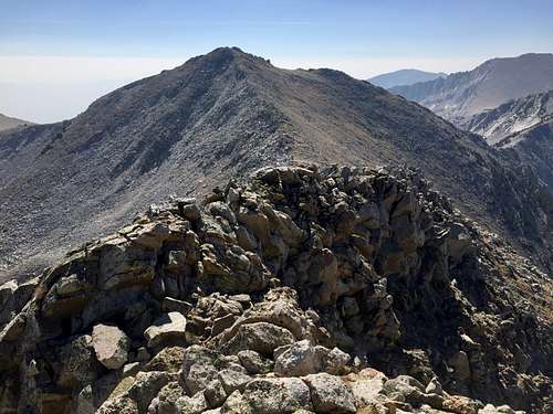
There is a natural pathway that requires some class 3 scrambling. The very first part is the steepest and has a little exposure, but then eases up. The hardest part ends after less than a quarter mile, and then the rest is boulder hopping to the summit of Haystack Peak. It is 5.4 miles one way to the summit. To give some perspective, those familiar with the Pfeifferhorn in Utah's Wasatch range will find the knife-edge ride scramble very similar. Overall, I would say the scramble to Haystack is a little easier and has a little less exposure, but is longer.
You must then return over Ibepah Azimuth before descending. The ascent would work very well as a descent. I descended almost straight back to the parking area from the east side of Ibepah Azimuth's north slope, creating a loop, with the descent being about 2 miles.
However, the lower half is very steep, requires a lot of bushwhacking and working around deadfall, and the ground turns into a nasty loose soil/pine needle/pine cone combo that quickly got annoying, but it did the job without any major obstacles.
Essential Gear
External Links
https://peakbagger.com/climber/ascent.aspx?aid=1505728