
|
|
Route |
|---|---|
|
|
17.55°S / 149.815°W |
|
|
Hiking |
|
|
Half a day |
|
|
Slippery steep sections |
|
|
Overview
This is the most popular and best-maintained hiking trail on Moorea. Local guides take visitors to the pass most days of the week, and largely thanks to their efforts the trail is in great condition.
The path is now wide enough in most places that you barely even had to touch the surrounding vegetation. This is in stark contrast to most other trails in the interior of the island (including trails leading to the same spot), which can be overgrown and difficult to follow. As of August 2016, trail signage is now excellent. There is a map at the Belvedere, but there is a better map (with trails instead of just roads) at an earlier stop on the way to the Belvedere. There is excellent color-coded signage the entire way.
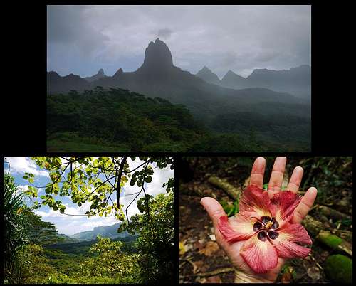
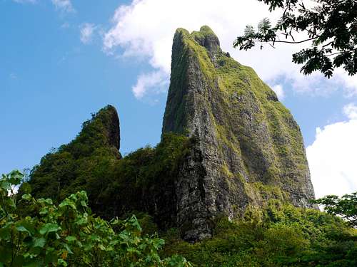
The trail begins at the Belvedere parking lot, heads west for a while passing a few dry creeks, then turns south and climbs up to the saddle between Mouaroa to the west and Mt. Tohiea to the east. This is about the highest point you can get to on those two peaks without some extreme climbing.
The net elevation gain is only 160 meters, and total elevation gain around 260 meters. Rewards for hikers include open vistas of the north and south coasts of the island, plus an up-close view of imposing Mouaroa and Tohiea.
Directions
There is no regular transit service to the Belvedere. Your options include a rental vehicle, taxi (very expensive), walking from the coast road (4.5 km from Opunohu bay, or 7 km from Cook bay via the Route de Ananas). Or you can try to hitchhike.
Renting a car or scooter on Moorea is recommended - unless you are content to stay in one place, having your own wheels can be cheaper than using private transfers/pickups and more flexible than the spotty bus service.
Essentials
- Allow 3 hours – you'll finish much faster if you hurry, but why hurry?
- Take at least 2 liters of water per person – you will sweat buckets.
- Bring comfortable footwear with good traction (no flip-flops).
- Usual outdoor common sense applies: avoid going alone; tell someone where you are going and when to expect you; be prepared for rain and emergencies.
Route Description
Once at the Belvedere, ignore the spectacular vista completely (you’ll see why in a moment). Find the trail heading west, i.e. on your right as you drive into the parking area. Keep left at the first junction. At the next one, a short detour continues straight to a viewpoint essentially identical to the Belvedere, but with a nice bench, and normally not another soul in sight. The main trail meanwhile heads sharply left then descends about 50 meters to the first creek.
The creeks are generally dry (in the dry season, anyway). Make sure to cross them and reconnect with the trail on the other side – it’s easy to end up following the creek bed instead, which is not what you want. Look for obvious steps marking the point where the trail hits the creek on either side.
Continue until you reach an opening in the trees with a view of Cook Bay. The trail to the pass heads up on your left (continuing straight will take you down to Opunohu bay). From here on it is a steady climb with some switchbacks to Three Coconut Trees pass. The trail narrows near the top and may be washed out in places, so watch your step.
There is at least one other trail leading to this spot, so make sure to pick the correct route on your way down. As of September 2013 it was possible to reach the pass from the south coast of the island too, although that route is a bit more challenging. Check with Mark at Mark’s Place Moorea for details.
schmmd - Aug 8, 2016 11:37 pm - Hasn't voted
Signage improvementsSignage is now excellent. There is a map at the Belvedere, but there is a better map (with trails instead of just roads) at an earlier stop on the way to the Belvedere. There is excellent color-coded signage the entire way--much better than trails in the Pacific Northwest! We only got off-trail once, and that was because someone put his jacket over a trail sign.
Scott - Aug 9, 2016 12:33 am - Hasn't voted
Re: Signage improvementsThanks for the updates!