
-
 26634 Hits
-
 81.18% Score
-
 13 Votes
|
|
Canyon |
|---|---|
|
|
46.65816°N / 88.71941°W |
|
|
Hiking, Sport Climbing, Toprope |
|
|
Spring, Summer, Fall, Winter |
|
|
Overview

Fall in the Sturgeon River Gorge.
The Sturgeon River Gorge is a spectacular yet seldom visited area in Michigan's Upper Peninsula. Situated roughly 12 miles southwest of Baraga and L'Anse, MI and down some pretty sketchy forest service roads, it doesn't see the number of visitors that the Porkies or Pictured Rocks might get but it is right up there in terms of solitude and scenery.
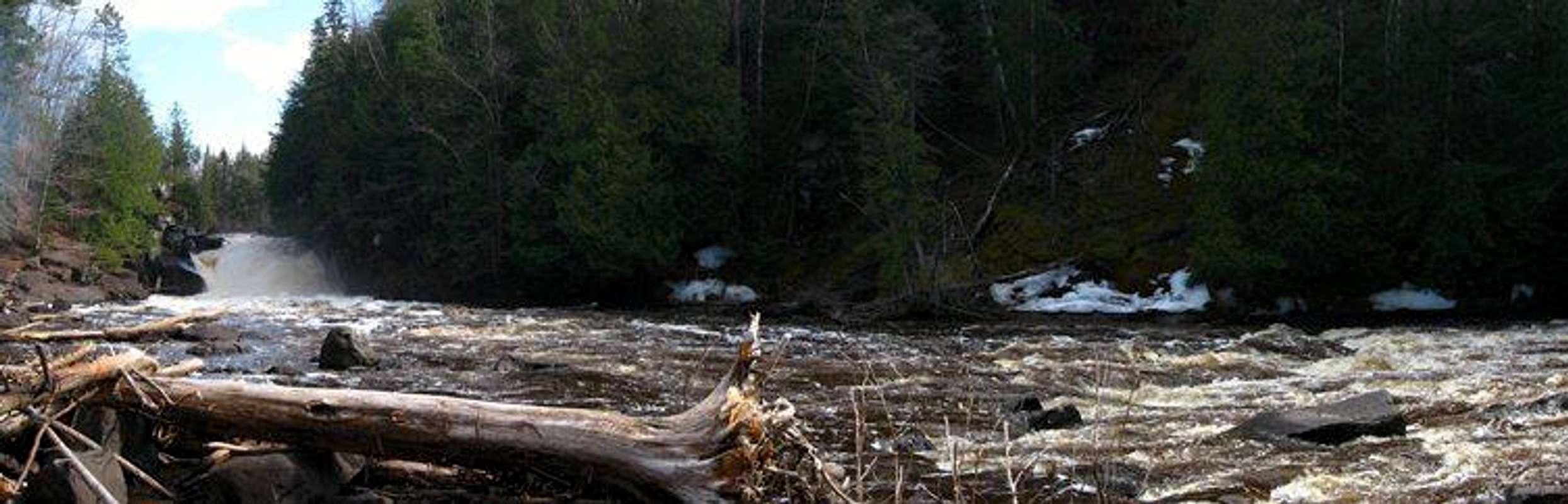
The Gorge is a natural wonder, and one of a kind in the Upper Midwest. At almost 300 feet deep in places and up to a mile wide at times, it really does offer the type of elevation change not often seen in these generally flat areas. The area is home to large stands of hardwood and hemlock, as well as some open slopes along the gorge rim. The gorge also boasts the Sturgeon Falls, which is a powerful series of waterfalls in the midst of the gorge that can become outright dangerous when the water level get high enough.
 |
The falls (see dwhike's page for a little more info) are probably the most visited area of the wilderness, and as such have the most developed trails and parking areas. The hike in is a peaceful one and has numerous beautiful views across the gorge from the rim before plunging down into the bottom to gain access to the falls. Other trails in the area include a sizable portion of the North Country Trail. Snowmobiles find a home here come winter, as much of the wilderness is completely inaccessible to those without a 4x4. Some daring folks also canoe and kayak the gorge when the water levels are high enough.
All in all, this area is a great place to spend a day wandering around and taking in the power of the river and is guaranteed not to disappoint.
 |
 |
 |
 |
Sturgeon Falls after a heavy rain event, September 2007:
Getting There

Though beautiful, the roads can be slightly confusing...
The easiest way to access the Wilderness, and the falls in particular is from Michigan State Highway 38. Head west out of Baraga until you get to Prickett Dam Road, about 10 miles. You will see signs for Silver Mountain and Sturgeon River Gorge (this is the last sign you will see for Sturgeon Gorge until you get there). Turn south on Prickett Dam Road and follow it almost to its end, almost 3 miles. Forest Service Road 193 branches off the the right just before Prickett Dam Road ends, follow it. Keep driving down FR 193, following the signs for Silver Mountain, for roughly 5 miles until you come to a distinctive split in the road where it tells you to turn right to go to Silver Mountain. At this split, turn left. (Actually it is more akin to just going straight, but to be clear: take the left branch of the road) You will then go down a decently steep hill and cross a bridge about 1 miles after the split. This bridge tells you you are on the right track. After climbing back up after the bridge, you have a few more miles (2 or 3) until the parking area. When coming from this direction, the small dirt parking lot will be on the left and the trail is on the right side of the road. It is tough to miss the sign, as it is almost in the road.

You might not believe it once you actually get there.
Alternately, some people make the drive from the south, which means more miles on the confusing Forest Service Roads. As far as I know, Off of Michigan State Highway 28, one needs to get onto Pequet Lake Rd (roughly 6 or so miles west of Covington, MI) and head north, following Forest Service Road 191 until it connects to FR193. You will turn left onto FR 193 and the parking lot is roughly 1.5 miles from the intersection, on the right this time.
Red Tape
There are no fees to enter the wilderness or to camp. Just remember to Leave No Trace and clean up after yourself and others. :)
Camping
The Sturgeon River Gorge Wilderness allows dispersed camping for no fee. There is also a slightly developed (by which I mean there are designated sites) nearby, available at no fee as well.
External Links
Wilderness.net Page
USFS Page
GORP Page
Sturgeon Falls
A great map of the wilderness, showing some highlights.