
|
|
Mountain/Rock |
|---|---|
|
|
39.89444°N / 16.21616°E |
|
|
Hiking, Mountaineering, Mixed, Scrambling, Skiing |
|
|
Spring, Summer, Fall, Winter |
|
|
7438 ft / 2267 m |
|
|
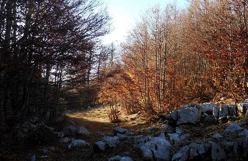
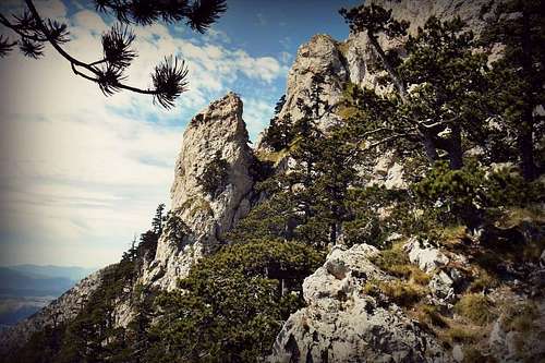
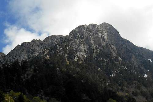
Serra Dolcedorme
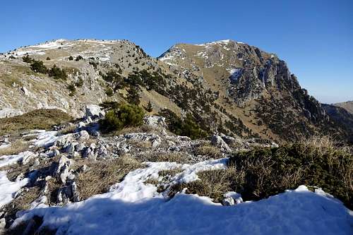
Serra Dolcedorme (from Celsa Bianca)
Serra Dolcedorme is the highest peak of the Pollino massif and, with the exception of the volcano Mount Etna (Sicily), also the tallest mountain in South Italy and the Southern Apennines. With a prominence of 1,715 m Serra Dolcedorme counts also among the ultra prominent peaks of Europe. The parent peak has a total elevation of 7,437ft / 2,267m. It is flanked by two subsidiary summits, Timpa di Valle Piana (7,096ft / 2,163m) and Timpa del Pino di Michele (6,788ft / 2,069m). Because of their substantial prominence both of them are commonly acknowledged as independent peaks.
Like all other peaks of the Pollino massif, also Serra Dolcedorme is a non-technical mountain, i.e. generally it can be climbed without employing special equipment by anyone who is physically fit. Depending on the planned ascent route, the encountered weather conditions and the season a few preliminary considerations should be addressed, though.
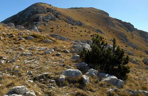
Compared with other peaks of the Pollino mountain range (Monte Pollino, Serra del Prete, Serra di Crispo etc.), the approach to Serra Dolcedorme is notably longer, making the ascent somewhat more demanding.
Especially on the southside of the moutain signposting is scanty and often improvised, for instance small cairns erected by hikers. From a northern direction trails are discernible to the trained eye, so orientation should be no major concern. The summit pyramid is also well visible from almost every spot of the central Pollino high plains.
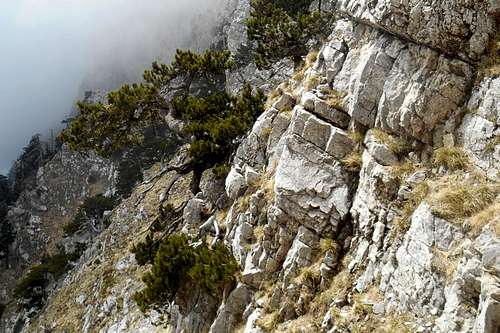
The base of the northern side has been shaped during the last glaciation. Its soft forms (for example the beautiful glade of Piano di Acquafredda), stand in stark contrast to the rugged rock walls of the mountain's south face.
The south face is perhaps the most impressive escarpment of the entire southern Apennines. Its crest, together with the steep walls of Timpa di Valle Piana and its precipitous flank, Celsa Bianca, offer a sublime view. An ascend from this side requires significantly more stamina and a good sense of direction. There is no source or watercourse to be found. Existing hiking trails are hard to make out and are often discontinued. There are several steep gullies and ravines right beneath the summit and orientation can become difficult, in particular with fog or low clouds.
 Serra Dolcedorme (the west ridge) |  Serra Dolcedorme (from the south) | 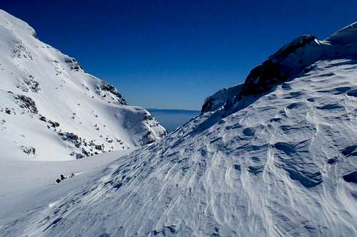 Serra Dolcedorme (from Timpa di Valle Piana) |
Note: The term 'Serra' is another word for mountain (ital. monte) and usually indicates mountains with either a prolonged summit ridge or a main peak with a number of subsidiary summits (or non-independent peaks). It finds a use especially in the southern parts of the Apennine mountains.
Summit Panorama
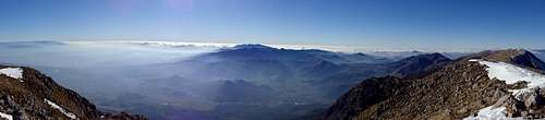 Panorama - Serra Dolcedorme (W - NW) | 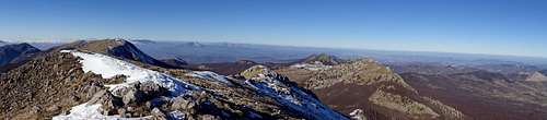 Panorama - Serra Dolcedorme (N) | 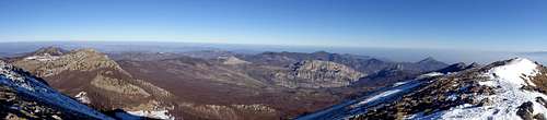 Panorama - Serra Dolcedorme (E - SE) |
Routes
1. West ridge (via Piani di Pollino & Sella del Malvento) - hiking
The trailhead for the standard route is Colle d'Impiso (5,160ft / 1,573m). From the road follow the dirt track to the highest point and keep to the broad forest track where it bends to the left. The forest track will lead first down to the bottom of a valley called 'Piano di Vacquarro'. (Note: There are two plains with the same name. This is the lower one. The higher one can be reached by aiming for the pass between Serra del Prete and Monte Pollino.) At the first junction turn left (direction: 'Piani di Pollino', 'Fontana Rummo'). The trail is now flanking the bank of the torrent Frida. Keep somewhat to the left where the trail enters again the beech forest. The trail is easy to follow as it winds its way upwards to the Pollino high plains. Keep ascending until you reach the first of the three central high plains, 'Piano di Toscano'.
Serra Dolcedorme (seen from Piano di Toscano)
Turn right and aim for the right edge of the wood that covers most part of the slope up to the col ('Sella Dolcedorme'). A hiking pass winds up the beneath the trees. On the col turn left and keep following the path. Now there are two options: the first one is ascending the peak of Timpa di Valle Piana, the second one would be bypassing the peak on the left. From here the west ridge surges straight up to the summit.
2. North ridge (via Piani di Pollino & Passo delle Ciavolle) - hiking
There are two recommended trailheads for approaching the north ridge: Colle d'Impiso and Casino Toscano. From the former simply follow the same itinerary as for the west ridge until you reach the high plain 'Piano di Pollino'. But instead of turning right, head straight and aim for the lowest point of the col between the beautiful south face of Serra delle Ciavole (to the left) and Serra Dolcedorme (to the right) until you come upon a narrow hiking path which leads to the col. Reached the pass ('Passo delle Ciavole'), turn right and follow the col up towards the north ridge.
 Passo delle Ciavole | 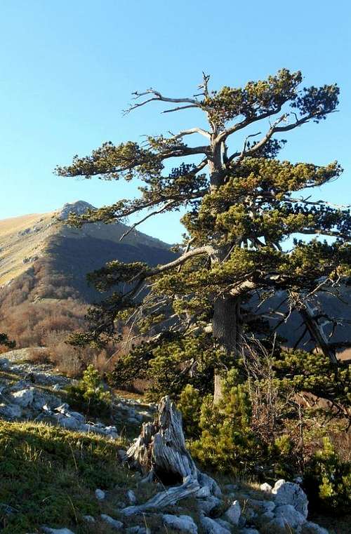 North ridge | 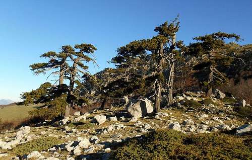 Group of Bosnian Pines on the col |
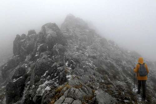 On the ridge (October) | 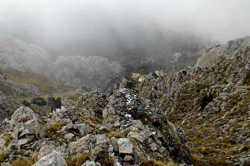 A look down the the south face | 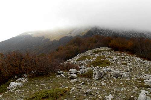 The north col |
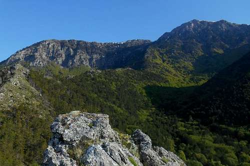
Both options allow equally beautiful views over the central high plains (north), an immense beech forest of 'La fagosa' (east), the glacial circle of the high plain 'Piano di Acquafredda' and the double peak of Monte Manfriana (south), the picturesque west face of Serra delle Ciavole and, to the south-east, right over to the severe looking cliffs of the impressive west face of Timpa di San Lorenzo and down to the coastline of the Gulf of Corigliano.
Possibly the best choice for a starting point is Valle Piana. Also Cozzo Palumbo may serve as a trailhead, but unfortunately the dirt tracks leading to the hill have become almost impassable without 4WD. From both locations the terrain slopes up towards the broad south ridge of the mountain, recognizable from a distance. The south ridge itself is pathless and very rocky. The ascend is not more than a moderate scramble, but it's real fun. Instead of scaling every single mass of rocks in the way, most of the major obstacles can also be bypassed. Do this, however, always on the east side, as the west side is not only more exposed but also rife with loose terrain and slippery tufts of grass which can become quite unpleasant, in particular when wet.
![Onset of the south ridge of Serra Dolce Dorme]()
Onset of the south ridge - Serra Dolcedorme![Serra Dolcedorme (south face)]()
Amphitheater - south face Serra DolcedormeThe ridge is halved by a pass ('Passo di Valle Cupa') where the hiking trails from Valle Piana and Cozzo Palumbo meet. There are some remains of the park's old signposting in this area. In a north-eastern direction (from the pass) runs an overgrown hiking trail ('Via Dolcetti', see 4.) which traverses the woods of Valle Cupa and a large clearing. Keeping on to the crest of the south ridge, instead, you will soon reach the summit wall of Serra Dolcdorme. To the left opens a fantastic view on the rock face of Timpa di Valle Piana and the long and almost vertical cliffs of Celsa Bianca, to the right on the undulated forest canopy of Valle Cupa.) Turn left and traverse the slope until you come upon a wide and steep scree ramp.
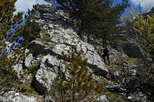
At around 6,500ft / 2,000m and already beyond the tree-line, the lightning struck and sometimes badly burned Bosnian Pines on this slope are still alive. These trees are even more impressive in this bare and rugged scenery. Some of the primeval giants reach almost 100ft / 30m. Depending on the weather conditions, the seasonal snow and the equipment you brought, you may either climb up to the summit in a direct line or continue the traverse and ascent first the less steeper slope to the pass between the west ridge and Timpa di Valle Piana. For the first option simply follow the scree ramp up to the narrow gully and keep to the left crag. Only a few more passages of easy scrambling - up to II (UIAA) - and you are on the summit.
3. South ridge (and central gullies) - scrambling/mixed climbing (PD / AD+)
Possibly the best choice for a starting point is Valle Piana. Also Cozzo Palumbo may serve as a trailhead, but unfortunately the dirt tracks leading to the hill have become almost impassable without 4WD. From both locations the terrain slopes up towards the broad south ridge of the mountain, recognizable from a distance. The south ridge itself is pathless and very rocky. The ascend is not more than a moderate scramble, but it's real fun. Instead of scaling every single mass of rocks in the way, most of the major obstacles can also be bypassed. Do this, however, always on the east side, as the west side is not only more exposed but also rife with loose terrain and slippery tufts of grass which can become quite unpleasant, in particular when wet.
Onset of the south ridge - Serra Dolcedorme
Amphitheater - south face Serra Dolcedorme
At around 6,500ft / 2,000m and already beyond the tree-line, the lightning struck and sometimes badly burned Bosnian Pines on this slope are still alive. These trees are even more impressive in this bare and rugged scenery. Some of the primeval giants reach almost 100ft / 30m. Depending on the weather conditions, the seasonal snow and the equipment you brought, you may either climb up to the summit in a direct line or continue the traverse and ascent first the less steeper slope to the pass between the west ridge and Timpa di Valle Piana. For the first option simply follow the scree ramp up to the narrow gully and keep to the left crag. Only a few more passages of easy scrambling - up to II (UIAA) - and you are on the summit.
From the amphitheater that opens at around 2,000 m it is possible to choose between a number of short but varied climbing routes. Difficulty, depending on snow conditions, between PD ('Direttissima' and its variants) and AD+ ('Scaletta di Mimmo').
![Descending 'Via Dolcetti']()
'Via Dolcetti' - south face Serra DolcedormeA round trip would be extremely taxing, and an overnight bivouac might become necessary. The "two-cars-solution" may seem to be an option, as well, but consider that the overall distance between one trailhead an the other can easily sum up to 70 km (one way) or even more, and the quality of the mountain roads is modest. ![Rock face on 'Via Luzzo']()
Rock face on 'Via Luzzo' - South face Serra DolcedormeIt is also possible to start out from Cozzo Palumbo (or even Valle Piana) and cross the extensive forest of Valle Cupa in order to ascend via the so-called 'Via Dolcetti'. This is one of the harder, surely one of the most rewarding ways to the summit. Overcome the gullies, it is an easy and attractive walk along rugged crest of the east ridge.
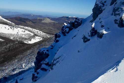
Before reaching the summit ridge several narrow and pretty steep gullies will have to be traversed. The ubiquitous and betimes insidious scree ramps can be evaded by sticking close to the gully walls. Rockfall is occurring infrequently, but bringing a climbing helmet might be a good idea.
As pointed out before, the south side of Serra Dolcdorme offers no possibilty to refill your water supply.
4. East ridge (via Timpa del Pino di Michele or 'Via Dolcetti') - scrambling/climbing (F)
This ascend route could be part of a complete traverse of the southern line of the Pollino massif. Sometimes called the 'Traverse of the Infinite', this very long and varied hike starts at a location in vicinity to the Calabrian town of Civita ('Colle della Scala') and terminates at Colle d'Impiso. Starting from the east it touches the peaks of Timpa del Principe, Serra di Malaverna, Monte Manfriana, Timpa del Pino di Michele, Serra Dolcdorme, Timpa di Valle Piana, Serra del Pollinello, Monte Pollino and Serra del Prete.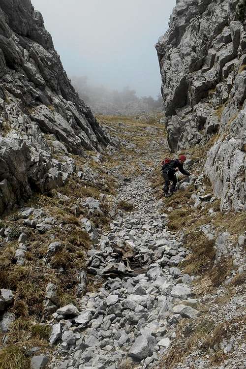
'Via Dolcetti' - south face Serra Dolcedorme
Rock face on 'Via Luzzo' - South face Serra Dolcedorme
Before reaching the summit ridge several narrow and pretty steep gullies will have to be traversed. The ubiquitous and betimes insidious scree ramps can be evaded by sticking close to the gully walls. Rockfall is occurring infrequently, but bringing a climbing helmet might be a good idea.
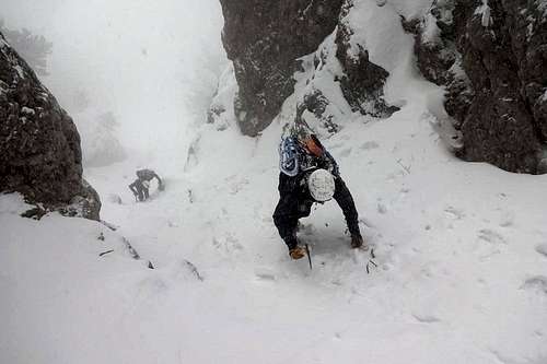
Although the approach is certainly long and rather demanding, a winter ascent is absolutely worth the effort. The scenery is staggering and the iced rock flutes are sensational.
'Via Dolcetti' can also be used as a descent route, but the serious inclination (in some parts easily 50 degree, or more) in combination with the loose terrain, scree and unstable tufts of grass make the slope difficult (and tiring!) to negotiate in a downhill direction.
![Denti del Dolcedorme, Serra Dolcedorme (south face)]()
Denti del Dolcedorme, south face Serra DolcedormePossibly the hardest route to date is the so-called Via Pietra Colonna which uses a steep gully on the south face of the mountain. There are several variations with passages around III+ / IV+ UIAA (85°) D-, depending on the season and the snow conditions inside the gully. The route is named after a prominent rock pillar to be found shortly after the crux section.
'Via Dolcetti' can also be used as a descent route, but the serious inclination (in some parts easily 50 degree, or more) in combination with the loose terrain, scree and unstable tufts of grass make the slope difficult (and tiring!) to negotiate in a downhill direction.
One more recommendable descend route is via the west ridge and a traverse of Timpa di Valle Piana. After following the long ridge of Celsa Bianca to 'Varco del Pollinello' you should come upon a quit well distinguishable path which first descends in a south-eastern direction before zigzagging downhill towards the valley below (Valle Piana).
Another, somewhat more demanding descend is possible via the east ridge. After a traverse of Timpa del Pino di Michele simply follow the inconspicuous trail which runs along the ridges of Cozzo Sorvolato, Colle Campanaro and Timpone Campanaro. In the extensive woods orientation can be complicated not only by the high trees, but also by smaller trails which only all too often turn out to be leading nowhere.
In winter the south face of Serra Dolcedorme offers a number of challenging climbing routes which mainly use steep and narrow snow couloirs. Although the approach might be long the snow and ice covered rock chutes are a very impressive sight.
5. South face ('Via Pietra Colonna') - scrambling/climbing/mixed climbing (D-)
Denti del Dolcedorme, south face Serra Dolcedorme
The developement of the route, approach included, sums up to 1,500 m (positive elevation gain) and features some more or less exposed passages on steep rock with only a few usable hand and footholds and scarce options for placing protection gear. Being exposed to the southern sun (south face), during the winter months the route should be tackled early in the morning. Rock fall and minor avalanches are not unlikely to occur.
![Climbing Via Luzzo]()
Climbing 'Via Luzzo' - south face Serra DolcedormeThe Via Luzzo shares both trailhead(s) and approach with the above 'Via Pietra Colonna'. Also the positive elevation gain is comparable to that route. Though it holds minor climbing difficulties, the upper part of the final gully is quite steep, especially the last 50 m right below the ridge.The slope angle below the ridge and the somewhat exposed passages should not be underestimated. In winter snow conditions should be valuated with care.
![Panorama (south ridge Serra Dolce Dorme)]()
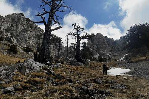
Bosnian Pines (Pinus leucodermis)
Free camping is generally not encouraged. But it might be tollerated from dusk until dawn and as emergency bivouac. No open fire etc. will be tolerated, though. There are no fees or permits required.
Accomodation, mountain huts etc.
Essential equiment, both with and without snow: climbing helmet, harness, rope, pitons and a number of larger slings. Winter ascents will require crampons, a couple of ice axes, technical or semi-technical. Snow anchors can become handy, too.
Trailhead is either Valle Piana or Cozzo Palumbo.
6. South face ('Via Luzzo') - scrambling/mixed climbing (AD-)
Climbing 'Via Luzzo' - south face Serra Dolcedorme
Indeed, winter ascents require crampons and at least one ice-axe. Depending on the snow conditions a second ice-axe will considerably contribute to your safety. Because of occasionally occurring rockfall, and larger chunks of ice coming down the gullies, a helmet is essential, too. Rope and protection gear are not necessarily reqiured for this route but might become handy, especially on the rocky steps of the first chute and on the last steeper passage right beneath the ridge. Since there are only a few useful for placing protection a snow anchor seems a natural choice.
*For additional information about some of the trailheads mentioned above, you may also have a look at the respective section of general page dedicated to the Pollino massif.
A few landmarks & impressions
 Serra Dolcedorme (south face) | 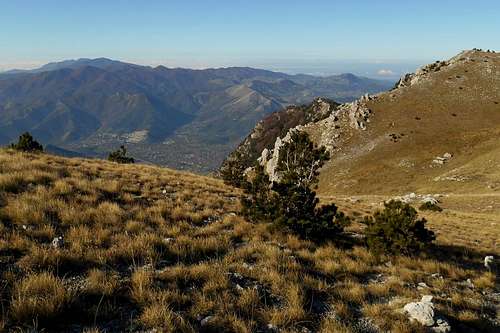 Orsomarso mountains (from the west ridge) |  Monte Pollino (from Serra Dolcedorme) |
 Timpa La Falconara (from the north ridge) | 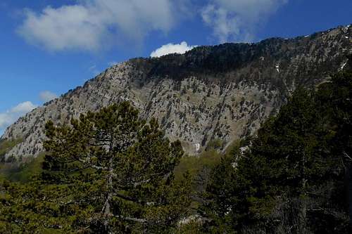 Celsa Bianca (from the south ridge) | 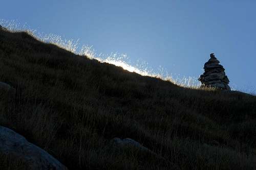 Cairn (west ridge) |
 South ridge (from Cozzo Palumbo) | 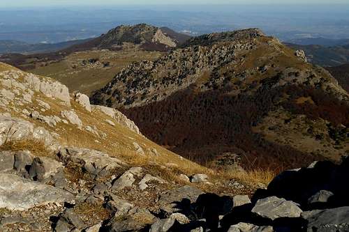 Serra Delle Ciavole and Serra Di Crispo | 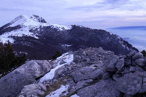 from Serra del Pollinello |
Getting there
The nearest airports are Naples (about 230km), Bari and Brindisi (also about 220-230km). From Rome and its big international airports it is a considerably long journey of almost 450km. There is limited public transport in this region.
The actual mountain roads are largely in bad conditions, especially the high passes might become impassable after snowfalls as road patrol service is scarcely to be seen around. If you should consider to visit the Pollino Massif between late October through early May, don't forget to bring snow chains or allow extra time for the approach way.
![Pollino massif from the south]()
Pollino massif from the south
The actual mountain roads are largely in bad conditions, especially the high passes might become impassable after snowfalls as road patrol service is scarcely to be seen around. If you should consider to visit the Pollino Massif between late October through early May, don't forget to bring snow chains or allow extra time for the approach way.
- from Napoli: Take the A3/E45 in direction Reggio Calabria, Salerno (about 195 km). Take the Exit (Uscita) Lauria Sud and follow thestate the State Road SS19. At Castellucio Inferiore turn left and follow the indications for Viggianello or San Severino Lucano. - Alternatively, you may leave the A3/E45 at the location Pecorone and
follow indications for the State Road SS653 (called "Sinnica"). Take the Exit Valle Frida and follow indications for San Severino Lucano. - For an approach from the south keep on the A3/E45 and take the Exit Morano Calabro or Castrovillari.
Pollino massif from the south
- from Bari: Take the State Road SS100 (or the highway A14/E843) for Taranto. Turn left (indications for Jonica/Palagiano/Matera/Reggio Calabria) and take the coastal road E90. After passing Policoro pay attention, as the Exit can easily be missed, and turn left, taking the State Road SS653 (indications for "Sinnica". Take the Exit Valle Frida and follow indications for San Severino Lucano. - For an approach from the south keep on the E90, take the Exit Villapiana Scalo and follow the State Road SS92 in direction Castrovillari.
- from Brindisi: Simply take the E90 for Taranto and keep on this road. After Taranto follow the same indications as above (Bari).
Red Tape
The Pollino massif, and hence Serra Dolcedorme, is an integral part of the 'Pollino National Park'. With an area of 1,960 square kilometres it is the most extensive national park in Italy. The park was officially founded in 1988. The same rules apply as for any other national park in Italy.
Bosnian Pines (Pinus leucodermis)
Free camping is generally not encouraged. But it might be tollerated from dusk until dawn and as emergency bivouac. No open fire etc. will be tolerated, though. There are no fees or permits required.
When to Climb
Serra Dolcedorme can be climbed all the year round. Snow is not to be expected before early November but usually lasts until late April or even May. For winter ascends essential mountaineering gear is recommended, a good pair of crampons and a single ice axe should do for most routes. Some of the narrow gullies of the south face are considerably harder to negotiate, though. Avalanches are rare but still possible on the steeper parts of the south side. - During the hot summer month, especially from the end of July through late August and early September, the high day temperatures should be taking into account before choosing an ascent route. The peak of Serra Dolcedorme (January) - from the west ridge |
Accomodation, mountain huts etc.
There are several mountain huts officially listed for the Pollino Massif. But, truth be told, almost all of them are by now either closed or in a piteous state (and closed, of course). To name only the few exceptions from the rule:
- Rifugio Fasanelli (Pedarreto, 4429ft / 1,350m) - to reach from Rotonda (8,5 km from the town center), situated only a few kilometers from the main trailheads Colle d'Impiso and Piano di Ruggio: open all year, 12 rooms with showers, full board. Phone: (+39) 973 667304
- Rifugio de Gaspari (Piano di Ruggio, 5,036ft / 1,535m) - to reach both from Viggianello and San Severino Lucano and close to the trailheads Colle d'Impiso and Piano di Ruggio: open all year, with 3 rooms (with 4, 5 and 7 beds), bathroom with showers. Phone: (+39) 973 661 813. - currently in renovation!
- Rifugio Madonna di Pollino (Madonna di Pollono, 5,085ft /1,550m) - accessible from San Severino Lucano (or Terranova Pollino) and close to the homonymous trailhead and the trailhead Bosco Iannace: Phone (+39) 973 576 418
- Bivouac Colle Gaudolino (Colle Gaudolino 5,524ft / 1,684m) - situated right on the pass between the major peaks of Serra del Prete and Monte Pollino, it can be reached by feet from either Piano di Ruggio or Colle d'Impiso: always open, unguarded, no service, water can be found at a fountain nearby or the natural well "Spezzavummola".
Accomodation can be found at Castrovillari, Frascineto and Morano Calabro (south) or San Severino Lucano and Viggianello (north). Camping grounds are open during the summer month at Mezzana Salice - San Severino Lucano (Phone: 349 636 2056 – 340 374 9086)
Maps & Guides
- Maps in a scale of 1:25.000 are available for purchase directly from the IGM - Istituto Geografico Militare (search terms/key words: Frascineto, Castrovillari) or have a look at the respective section for the Pollino massif.
- Sud Verticale, author: Guido Gravame, Idea Montagna 2015. - Guide book with a great number of rock and winter climbing routes on the Southern Apeninnes.
- Appennino Meridionale, author: Luigi Ferranti, Guida dei Monti d'Italia 2010. - Most comprehensive guide to the Southern Apennines (hiking paths and climbing routes to all major peaks) available.