
|
|
Route |
|---|---|
|
|
50.88889°N / 114.80617°W |
|
|
Hiking |
|
|
Spring, Summer, Fall, Winter |
|
|
Half a day |
|
|
Moderately strenuous day hike |
|
|
Overview
This is the standard route up Prairie Mountain, climbing up the treed southeast rib of the mountain. While still an unofficial trail, it is nevertheless exceedingly popular (easily one of the most popular hikes in the Canadian Rockies) with locals and very well trodden. While relentlessly steep, it's quite scenic and of course Prairie Mountain is a fabulous viewpoint.
Total elevation difference is 700 metres exactly (2297 feet), from 1506 metres (4941 feet) to 2206 metres (7234 feet).
Getting There
As described under Prairie Mountain's main page but I'll reiterate here. From the hamlet of Bragg Creek (20 minutes west of Calgary) drive south on Highway 22 (Alberta' Cowboy Trail) to the first big T intersection and turn right on Highway 66 (Elbow Falls Trail). Continue driving west into Kananaskis Country and over the Elbow River. The highway curves around to the left past the south end of the Moose Mountain massif, dips into the valley of Canyon Creek, and continues to the winter gate beside Elbow Falls. When the winter gate is open (May 15-December 1) park in Beaver Lodge parking lot (really just a large, paved pullout). Otherwise park in front of the gate. Even on frigid winter days there are usually lots of cars here.
Route Description
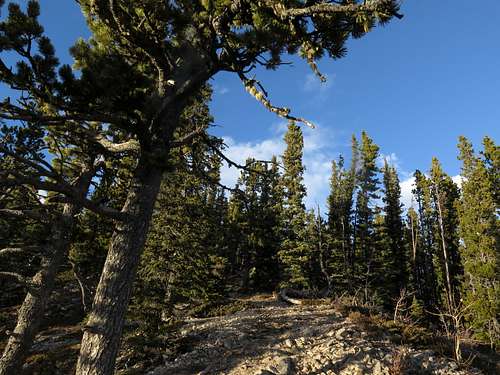
Between the gate and Beaver Lodge parking lot (400 metres apart) the road crosses Prairie Creek and a large, obvious infill. Above Prairie Creek to the right you can see a trail heading up a little ridge. Follow this trail up the ridge to an overlook above the valley (10 minutes) then turn left and follow the trail along a scenic, flat section of ridge crest under open pines. At the end of this flat stretch in slightly thicker forest (still very open), the trail begins to climb straight up. It's a bit eroded and is badly in need of switchbacks. Eventually, the trail reaches an open, rocky crest about two thirds of the way up the rib with some beautiful limber pines, an easing of the angle and some views.
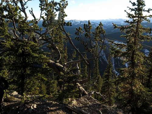
Turning right a bit, the trail climbs even steeper than before (this section is seriously slippery without traction devices in the winter) up a semi-open slope. You are definitely in the subalpine here and the trees are thinning out.
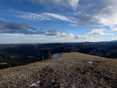
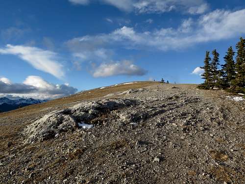
After what seems like an endless climb, you reach the windswept ridge crest just below treeline. Turn right and follow the open ridge crest to the very broad summit with its enormous cairn and signature Canada flag, not to mention its stupendous 360 degree view.
Essential Gear
Hiking poles, proper footwear and traction devices in the winter. This trail is very steep and gets quite slippery in the winter.
External Links
Kananaskis Country, Alberta Parks: https://albertaparks.ca/parks/kananaskis/kananaskis-country/
Elevations mentioned were measured to an accuracy of 1 metre by Dr Gérard Lachapelle and his team from the University of Calgary's Department of Geomatics Engineering. Here is a page with their results.