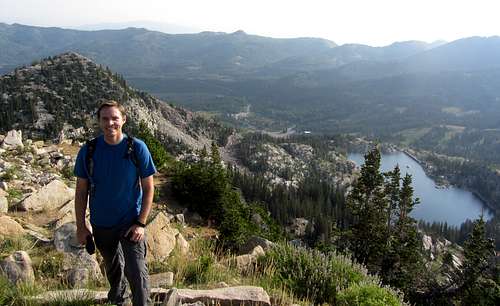
After taking two weeks off for my family’s big trip to Europe, work was so busy for the remainder of the summer and fall that I was only able to do one real summit hike with David. With that in mind, we decided to do the Brighton Ridge Run to bag as many summits as possible. We’d both been to the top of Sunset Peak already, so I was interested in doing a variation that would take us closer to more lakes, and would replace doing Pioneer Peak and Sunset Peak at the beginning by instead doing Honeycomb Cliffs at the end (the view of them from Willow Lake on the other side of Big Cottonwood Canyon made me want to check them out). Since we’d be returning down past Twin Lakes Reservoir at the end, David recommended tacking on Mount Evergreen as well, so this would give us six summits along with views of six lakes in one relatively easy hike. I wouldn’t really consider myself a peakbagger, but for those that do, the Brighton Ridge Run offers perhaps the lowest hanging fruit of any loop hike in the Wasatch.
![Mount Tuscarora over Lake Mary]() From Lake Mary, we had nice views of Mount Tuscarora ...
From Lake Mary, we had nice views of Mount Tuscarora ...![Mount Millicent over Lake Mary]() ... and Mount Millicent
... and Mount Millicent
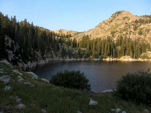
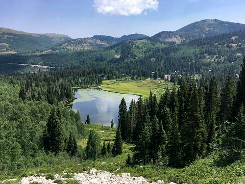
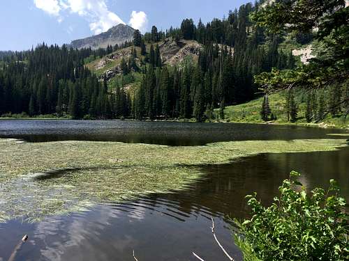
We met in the main parking lot at Brighton, which was surprisingly empty for 7am on a Friday morning. Despite not being in great shape, I knew that this hike would be relatively easy since it wouldn’t really involve much elevation gain or any real scrambling. We made quick progress up to Lake Mary (another reason we skipped Pioneer Peak is because we weren't keen on hiking through more groomed ski slopes), and shortly after that we passed by Lake Martha and Lake Catherine.
![Mount Tuscarora over Lake Martha]() Mount Tuscarora over Lake Martha
Mount Tuscarora over Lake Martha![Lake Mary]() Lake Mary
Lake Mary![Albion Basin]() Albion Basin
Albion Basin![Timp view from Mount Tuscarora]() Timp view from Mount Tuscarora
Timp view from Mount Tuscarora
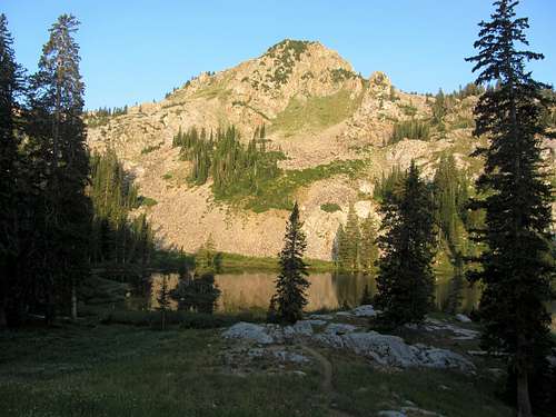
This time around I didn’t see any moose (on previous visits to Lake Catherine I’d always seen at least one), and it wasn’t until Catherine Pass that we ran into another group of hikers. We commiserated with each other about how much more foot traffic the Wasatch trails have been getting the last few years, but I guess I shouldn’t complain since I’m contributing to the problem by posting trip reports. We then dealt with the congestion problem by heading up the ridge towards Mount Tuscarora.
![Sunset Peak]() Sunset Peak
Sunset Peak | ![Devil's Castle]() Devil's Castle
Devil's Castle | ![American Fork West Twin]() American Fork West Twin
American Fork West Twin | ![Pioneer Peak over Lake Catherine]() Pioneer Peak over Lake Catherine
Pioneer Peak over Lake Catherine |
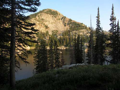
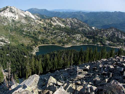
![Lake Mary from Mount Millicent]() Views of Lake Mary ...
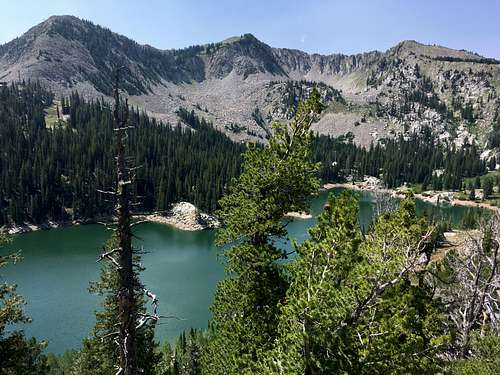
Views of Lake Mary ...![Twin Lakes Reservoir from Mount Millicent]() ... and Twin Lakes Reservoir from Mount Millicent
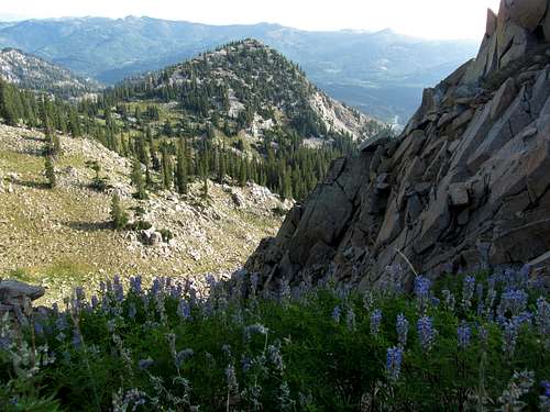
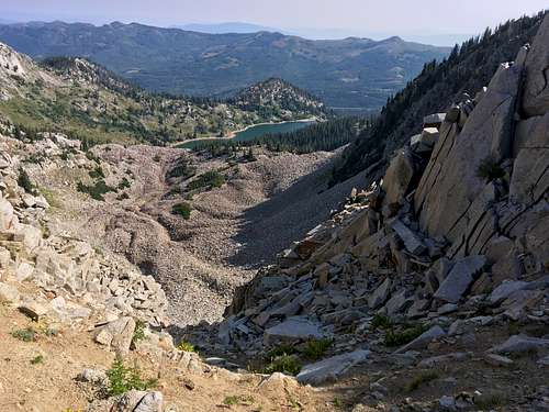
... and Twin Lakes Reservoir from Mount MillicentThere was a faint trail leading to the top, but this less-frequented area would give us complete solitude until our descent past Twin Lakes Reservoir. Heading up from Catherine Pass, we were greeted with nice views of the Bullion Divide Peaks across the other side of Albion Basin to the southwest, as well as Cottonwood Ridge to the west.
![Mount Tuscarora summit view]() Mount Tuscarora summit view of Lake Mary ...
Mount Tuscarora summit view of Lake Mary ...![Mount Millicent view from Mount Tuscarora]() ... and Mount Millicent below
... and Mount Millicent below
![Mount Tuscarora]() Looking back at Mount Tuscarora ...
Looking back at Mount Tuscarora ...![Mount Wolverine summit]() ... on the way to the top of Mount Wolverine
... on the way to the top of Mount WolverineFrom the top of Mount Tuscarora, we started along the ridge leading towards Mount Wolverine, and then cut to the right to lose some elevation on our way to Mount Millicent. As we got closer to the summit of Millicent we had to do some boulder-hopping, but it was pretty easy. On our second summit of the day we took a little snack break, admiring the views of Twin Lakes and Lake Mary from above. Despite all the smoke from recent fires in Utah and the surrounding western states, we were lucky to be hiking on a relatively clear day.
![Mount Millicent southwest ridge]() After a little boulder-hopping along Mount Millicent's southwest ridge ...
After a little boulder-hopping along Mount Millicent's southwest ridge ...![Pioneer Peak, Sunset Peak, & Mount Tuscarora from Mount Millicent]() ... we could look back at Pioneer Peak, Sunset Peak, & Mount Tuscarora from the top
... we could look back at Pioneer Peak, Sunset Peak, & Mount Tuscarora from the top
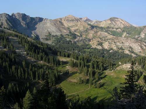
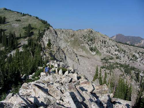
![Patsy Marley]() Passing over Patsy Marley ...
Passing over Patsy Marley ...![Twin Lakes Reservoir from Twin Lakes Pass]() ... on our way to Twin Lakes Pass
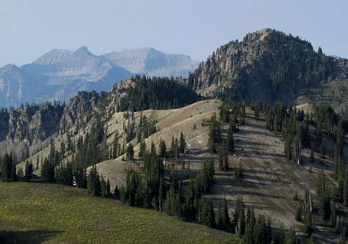
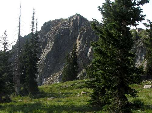
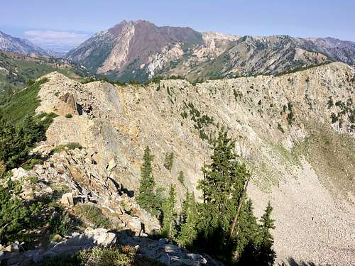
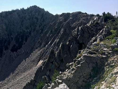
... on our way to Twin Lakes PassMost hikers hitting Millicent on the Brighton Ridge Run just descend from there back to the Brighton parking lot, but the more scenic way involves looping over Mount Wolverine (the highpoint of the hike) and descending via Twin Lakes Pass. To do this though, we had to regain 500 feet of elevation. Once at the top of Wolverine, you have a nice view of the looping ridge leading to Patsy Marley, the next summit of the hike. There is a faint trail on the ridge, so it’s quite easy to follow, despite this area containing the most rugged terrain of the hike (not quite as rugged as some of the bigger ridge scrambles we’d done along the Alpine Ridge or Cottonwood Ridge, though). Patsy Marley isn’t very prominent, but it is named.
![Rock Glacier below Wolverine Cirque?]() ... with a little talus field below that resembled a rock glacier
... with a little talus field below that resembled a rock glacier![Wolverine Cirque ridgeline]() The ridgeline we would follow around Wolverine Cirque ...
The ridgeline we would follow around Wolverine Cirque ...
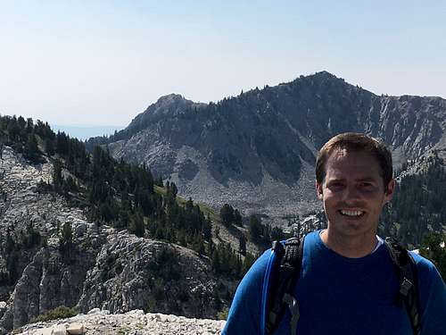
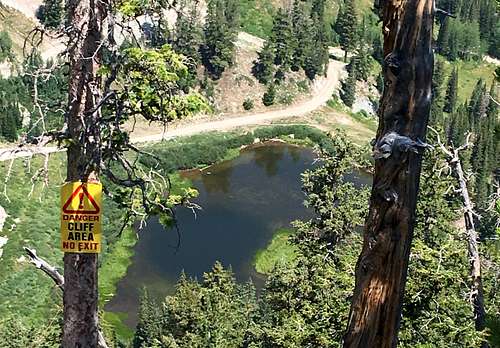
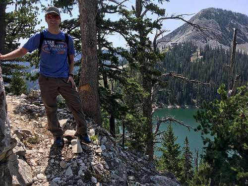
![Honeycomb Cliffs summit pic]() Honeycomb Cliffs summit pic
Honeycomb Cliffs summit picTo the west we could see all the way down Little Cottonwood Canyon, and it really puts into perspective the length of the WURL (stands for Wasatch Ultimate Ridge Linkup), which connects those ridges in one horseshoe-shaped route around the canyon. My friend Kendrick did over half of the route leading from Broads Fork Twin Peaks all the way to the Hidden Peak tram in a single day earlier that spring, which is way more ambitious than anything I’ve ever had the desire to do. Knowing enough about the various sections of the route, getting in good enough shape to even think about trying to do the 36 miles and 18k feet of vertical gain in one shot (most of which covers ridge scrambling terrain without any trails) isn’t something I’d be that eager to try, although I have to respect the ability of those who can do it. Someone recently pulled off the entire thing in just under sixteen hours, which is absolutely mind-boggling!
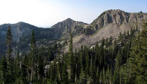
![Trail below Honeycomb Cliffs]() ... our path would take us on a scenic trail below Honeycomb Cliffs
... our path would take us on a scenic trail below Honeycomb Cliffs![Mount Wolverine Cirque]() After the descent from rugged Mount Wolverine ...
After the descent from rugged Mount Wolverine ...
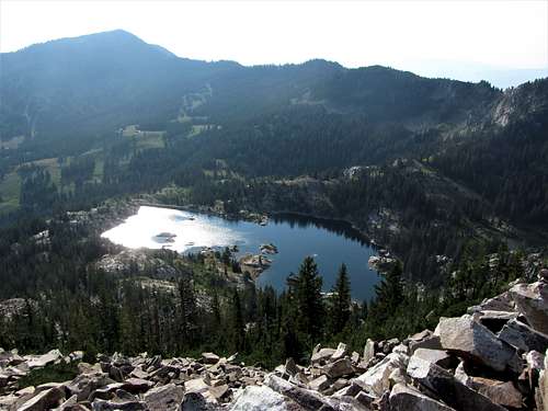
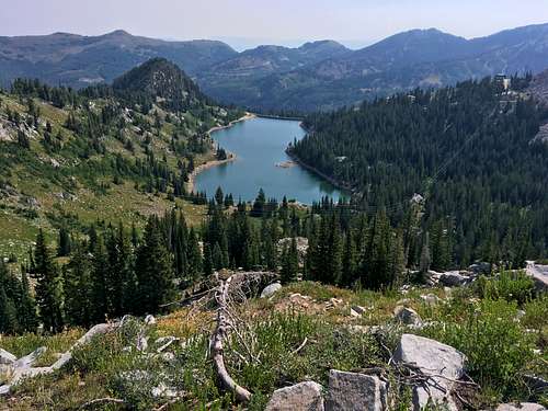
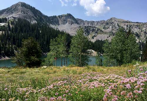
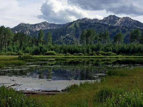
![Lake Solitude from Mount Evergreen]() Catching a brief glimpse of Lake Solitude ...
Catching a brief glimpse of Lake Solitude ...![Honeycomb Cliffs from Mount Evergreen]() ... and Honeycomb Cliffs from Mount Evergreen
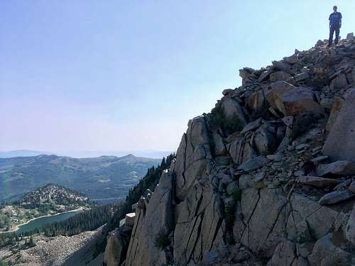
... and Honeycomb Cliffs from Mount EvergreenFor our modest hike, we just had a couple more summits to tag. After descending down to Twin Lakes Pass we started hiking along a trail leading north towards Honeycomb Cliffs. Apparently, we missed the faint use-trail that would’ve first led us up to the shorter east summit, so when the more obvious trail started losing elevation as it skirted below the higher west summit, we figured that we’d just need to make our way straight up the southwest slopes. It was a bit steep in places, so we made sure to do plenty of zig-zags on our way up to reduce the chances of knocking down loose rocks on each other. From the top, we were able to see the previous four summits we’d hit, as well as our last remaining one down to the east.
![Mount Superior from Honeycomb Cliffs]() ... along with Mount Superior and the Cottonwood Ridge peaks to the west
... along with Mount Superior and the Cottonwood Ridge peaks to the west![Honeycomb Cliffs summit view]() From the highest summit of Honeycomb Cliffs we could see all of the other peaks we'd hit on the way ...
From the highest summit of Honeycomb Cliffs we could see all of the other peaks we'd hit on the way ...
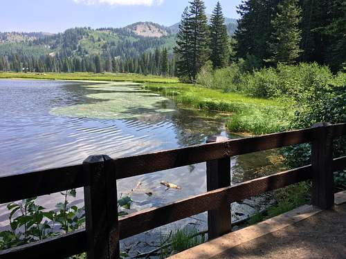
![Trail above Silver Lake]() On our way down to Silver Lake ...
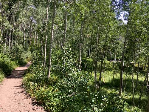
On our way down to Silver Lake ...![Aspens near Silver Lake]() ... we passed through a little grove of aspen trees
... we passed through a little grove of aspen treesDescending Honeycomb Cliffs was much easier than it had been going up, and from Twin Lakes Pass we knew we’d have a nice trail the rest of the way down. The small detour up Mount Evergreen was short and sweet, offering us some nice views of Millicent, Tuscarora, and Patsey Marley above Twin Lakes Reservoir, along with a brief glimpse of Lake Solitude below us to the north. At the northeast end of Twin Lakes I accidentally took a side-trail leading us a few dozen yards away from the main trail, but this was easily corrected. Soon we were back down at the Silver Lake boardwalk, soaking in the views with the others who had opted for an easier walk. From the boardwalk parking lot it was a short distance of a couple hundred yards along the main road to get back to the bigger Brighton parking lot where the car was parked.
![Millicent, Wolverine, & Patsy Marley over Twin Lakes Reservoir]() ... we had a nice view of Millicent, Wolverine, & Patsy Marley over Twin Lakes Reservoir
... we had a nice view of Millicent, Wolverine, & Patsy Marley over Twin Lakes Reservoir![Mount Evergreen trail view]() From the steep trail up Mount Evergreen ...
From the steep trail up Mount Evergreen ...
![Mount Millicent over Silver Lake]() Some of the scenery ...
Some of the scenery ...![Silver Lake]() ... on the easy boardwalk trail around Silver Lake
... on the easy boardwalk trail around Silver LakeThe Brighton Ridge Run offered some nice lake views and was a quick and easy way to hit several summits in one outing. While it isn’t as rugged as other parts of the Wasatch and doesn’t really have any scrambling, it’s still a fun hike that I’d highly recommend. I’ll probably bring my kids back to do an easy version that simply involves Tuscarora, Wolverine, and Patsy Marley, as that wouldn’t require any backtracking or extra elevation gain, although that can be part of the fun if you have a little extra energy.
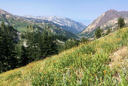
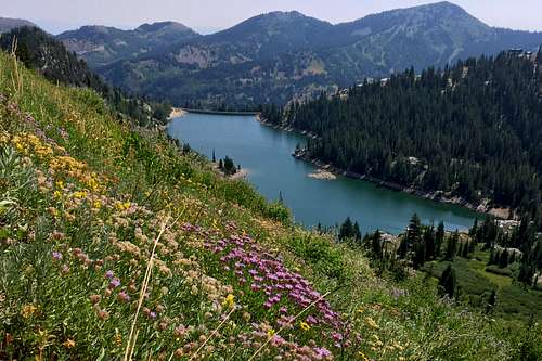
![Wildflowers over Twin Lakes Reservoir]() Despite it being a bit late in the season ...
Despite it being a bit late in the season ...![Twin Lakes Reservoir wildflowers]() ... there were still a few wildflowers around Twin Lakes Reservoir
... there were still a few wildflowers around Twin Lakes ReservoirBrighton Ridge Run Loop Stats
DISTANCE: 10 miles one way
LAKE MARY TRAILHEAD: 8,755 feet
MOUNT TUSCARORA ELEVATION: 10,660 feet
MOUNT MILLICENT ELEVATION: 10,452 feet
MOUNT WOLVERINE ELEVATION: 10,795 feet
PATSY MARLEY ELEVATION: 10,525 feet
HONEYCOMB CLIFFS ELEVATION: 10,500 feet
MOUNT EVERGREEN ELEVATION: 9,860 feet
SILVER LAKE TRAILHEAD: 8,755 feet
ELEVATION GAIN / LOSS: 3,500 feet / 3,500 feet
DIFFICULTY: Class 2
TIME: 6 hours
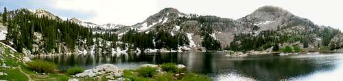
![Lake Mary Panorama]() Lake Mary Panorama
Lake Mary Panorama![Honeycomb Cliffs]() View of Brighton Ridge Run peaks (Millicent, Tuscarora, Wolverine, Patsy Marley, Evergreen, & Honeycomb) seen from Willow Lake
View of Brighton Ridge Run peaks (Millicent, Tuscarora, Wolverine, Patsy Marley, Evergreen, & Honeycomb) seen from Willow Lake


 Sunset Peak
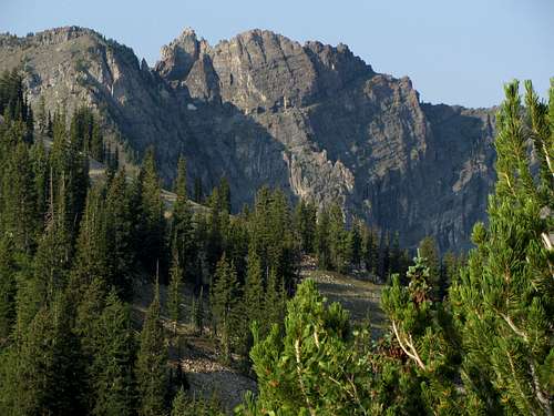 Devil's Castle
 American Fork West Twin
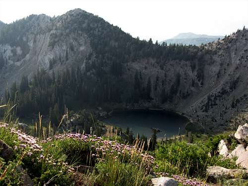 Pioneer Peak over Lake Catherine
Comments
Post a Comment