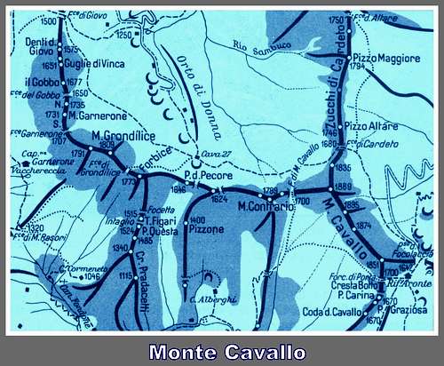
Alpi Apuane, as their name says, are comparable to the Alps rather than the neighbouring Northern Apennines, notwithstanding their distance from the alpine chain and their moderate height (the highest peak doesn’t join the 2000 meters of altitude). This fact is due to their steep and impressive walls, together with their geological origins. Monte Cavallo is a complex peak lying on the main apuan crest, between the Saddle of Cavallo and the Focolaccia Col. It’s shaped by a very long ridge NW-SE oriented, showing four fore-summits reaching approximately the same altitude; the highest point is lying in the middle of this ridge. Two others ridges are starting from the ends of the main one.
Monte Cavallo East face
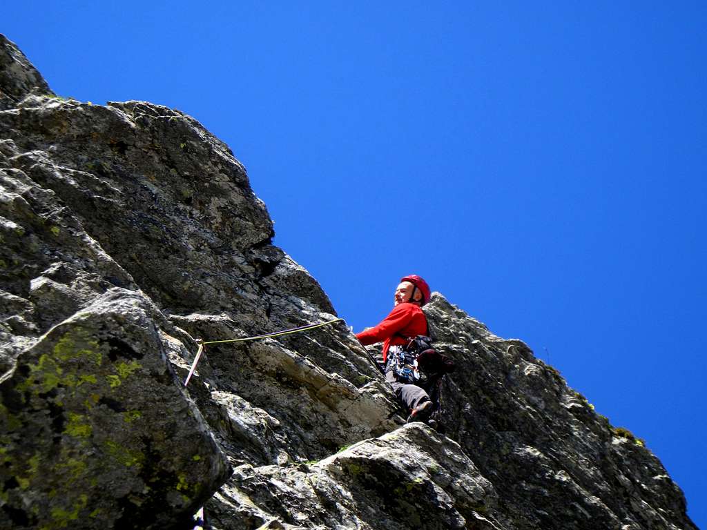
Cavallo has singular and symmetric shapes and it’s one of the best known and more frequently climbed peak in Alpi Apuane, in every season of the year; the beautiful and wide NE face and theSE one are often visited by the rock-climbers during spring, summer and fall, in reason of its interesting routes, while the Cambron Gully offers a very nice ice-climb during the winter months.
Focolaccia white marble quarry from the summit
Monte Cavallo summit ridge in winter
Getting There
Road access
This sector of Alpi Apuane can be reached both from the Lunigiana region and Garfagnana region.
- Coming from A15 Motorway (Lunigiana)
From the A15 Parma – La Spezia Motorway take the Aulla exit. From here follow the SS 63 towards Cerreto Pass, then after Rometta turn to right, following SS 445 towards Fivizzano, Casola in Lunigiana, Minucciano, Gramolazzo and Gorfigliano. At the end of Gorfigliano take the road towards Vagli, then turn to right following the road to the Campaccio quarries and leave the car before entering the tunnel, after which the road becomes dirty.
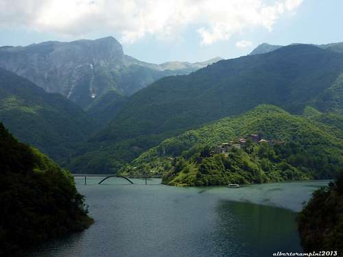
Lago di Vagli (Garfagnana)
- Coming from Garfagnana Valley
Getting to Castelnuovo Garfagnana take the road to Piazza al Serchio and Gorfigliano, then proceed as before.
Walking approach
From the tunnel either by foot or by a 4x4 follow the dirty road towards Focolaccia Col until you arrive underneath the NE face.
Routes overview
North East Face routes (French scale)
North-East Face counts some pleasant and interesting climbing routes, developing inside a singular mountain environment. From left to right:
- Gli Smemorati 6a, 250 m. - Via dei Cherubini 5b, 220 m. - Lovable 6a, 120 m - Arte e Maniera 6a, 200 m. - Occhio alla curva 6a, 160 m.
Gli smemorati upper traverse
The white slabs of Arte e Maniera
South-East Face routes (French scale)
On the narrow and shorter SE face you find six routes. From left to right:
- Paradiso Perduto 6a, 120 m. - Fog 6b+, 120 m. - Via dell’Architetto 6b, 90 m. - Fessura Centrale 4b, 100 m. - Via di Centro 4b, 100 m. - East Ridge 3a, 160 m.
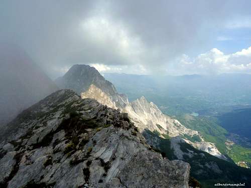
Monte Pisanino seen from Cavallo
Winter Ascents
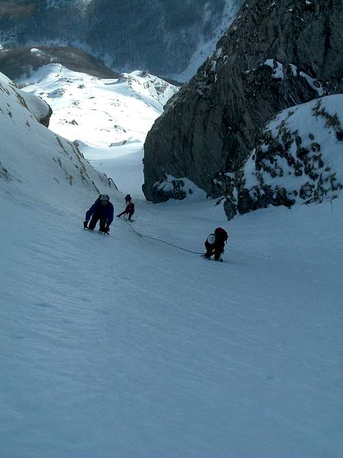
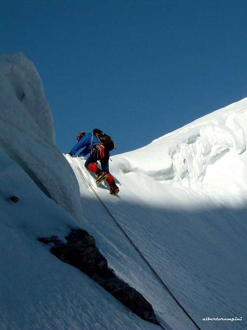
Canale Cambron
Difficulty: AD Exposition: North-East Starting altitude: 1630 Summit altitude: 1889 m Difference in level: 270 m the ice-climb, the approach from Gorfigliano involves 1000 meters more Starting locations: Gorfigliano (Lucca, MS) Support: Bivacco Aronte al Passo Focolaccia
A worthwhile classic Alpi Apuane winter climb. Along the gully, on the rocks to the left, there are some equipped bealys (often with old pegs and slings, to be checked).
Parties on Cambron Gully
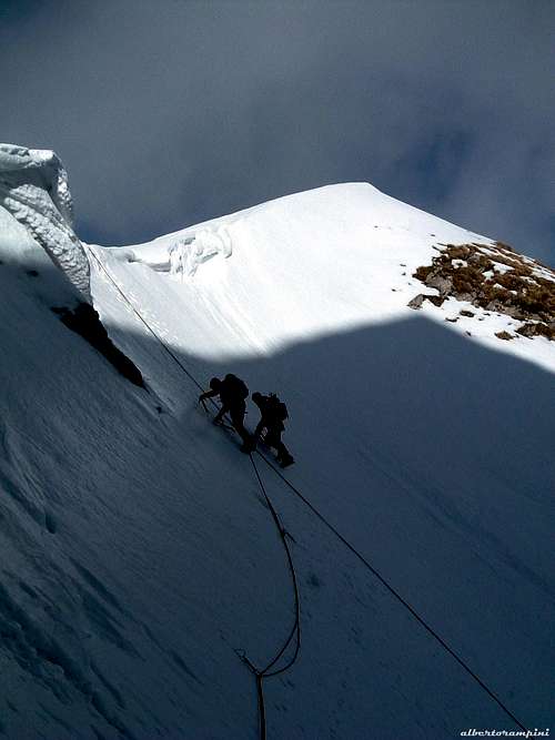
Cambron Gully
Cambron Gully: exit to the summit ridge
Route description
Approach: from Gorfigliano 680 m. follow the quarry roads to Focolaccia Pass (2,30- 3 hours by walk). In winter the approach can be very snowy. Once approaching Focolaccia Pass, before arriving to the pass skirt the North-East side of Monte Cavallo, to keep the obvious ice gully, wide in the first part then gradually narrowing (Cambron is the last gully encountered starting from Gorfigliano; a bit before is situated the most challenging Ceragioli gully). Up along the channel, which has a vertical gain about 200 m, with slopes around 30-40° at start, on the initial slopes, progressively increasing to 55° towards the exit, which is often overlooked by imposing frames. The gully exitsbetween Cavallo main summit and the northernmost summit; this latter can be reached quite easily by following the summit ridge to the right.
Descent. reversing the same route (faster), or crossing the summit ridge of Cavallo (sharp ridge of snow or mixed, with difficult passages) until reaching the normal route on SW slope (get off on the right just after quote 1874 m, and then to the 167 trail n. that leads back to Passo Focolaccia).
Red Tape
No particular restrictions in climbing and hiking, even if all Alpi Apuane range is situated inside a natural park – Alpi Apuane Natural Park – established in 1985 to protect the milieu and mostly to try restricting the age-old activity of marble’s quarrying, which has marked this magnificent but frail environment.
When to Climb
Rock climbs: from May to October Ice gullies: January and February
Parents refers to a larger category under which an object falls. For example, theAconcagua mountain page has the 'Aconcagua Group' and the 'Seven Summits' asparents and is a parent itself to many routes, photos, and Trip Reports.

 9695 Hits
 90.81% Score
 33 Votes


")