|
|
Mountain/Rock |
|---|---|
|
|
49.18992°N / 20.18248°E |
|
|
Mountaineering, Trad Climbing, Scrambling, Via Ferrata |
|
|
Spring, Summer, Fall, Winter |
|
|
8077 ft / 2462 m |
|
|
Overview
|
Glossary
štít (š=sh) = peak
sedlo = saddle/pass
štrbina = col
veža (ž=zh) = tower
dolina = valley
pleso = tarn
chata (ch=kh) = hut
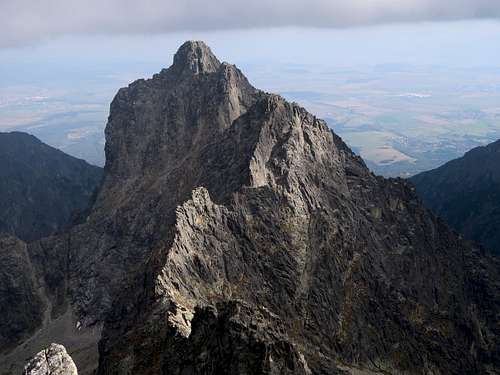
Široká veža (Slovak) Mały Lodowy Szczyt (Polish) 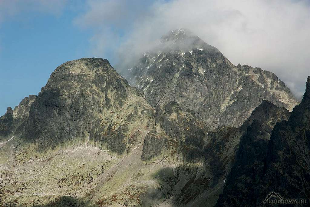
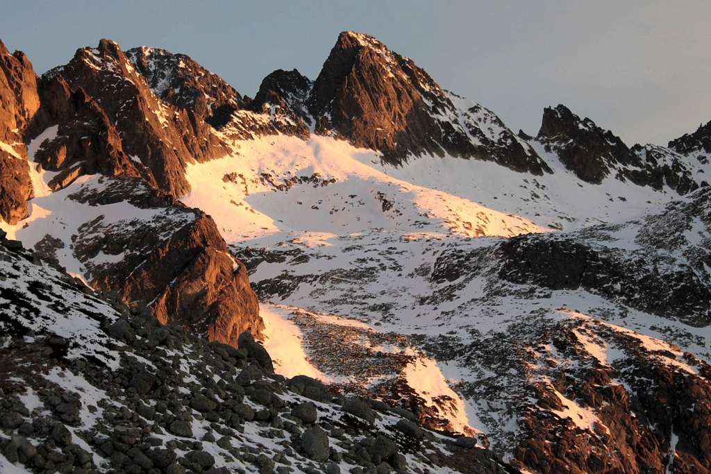
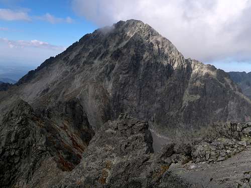
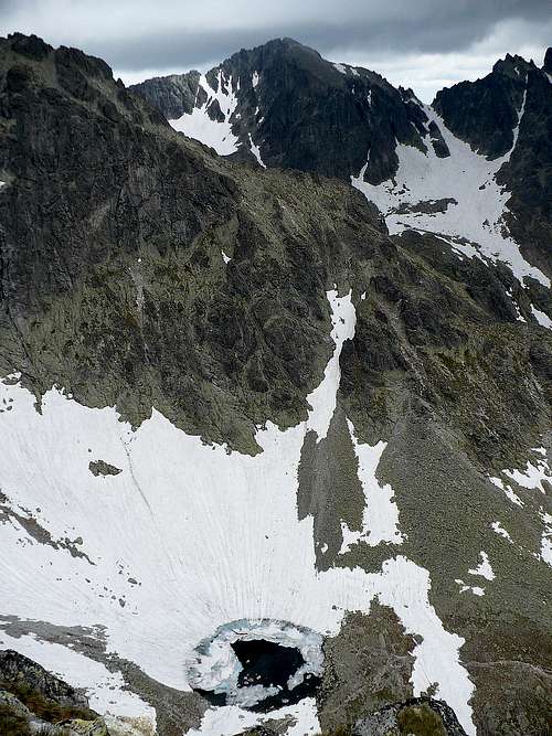
Széles-torony (Hungarian) Breiter Turm (German) The above photograph perfectly explains both the Slovak and the Polish names of the mountain. The former translates as Broad Tower whereas the latter means Little Ľadový štít. The German-speaking guides of the 19th century called the peak Roter Flussturm, which later on was shortened to Roter Turm/Červená veža, i.e. Red Tower. This name has fallen out of use though. Široká veža sits on the main ridge of the Tatra mountains where it takes a sharp bend to head north, to Ľadový štít. The peak is actually a junction of three ridges since it also sends a lateral ridge, crowned with magnificent Prostredný hrot, in the SE direction. Široká veža is divided from the massif of Ľadový štít (from its southern summit known as Malý Ľadový štít in Slovakia and Kopa Lodowa in Poland) by Sedielko (Little Saddle) at 2372m. In the west it is separated from Ostrý štít by the cols of Zbojnícke sedlo and Biela lávka (and the pinnacles of Zbojnícke veže between them), in the southeast from the ridge running to Prostredný hrot by Priečne sedlo at 2305m. Both Sedielko and Priečne sedlo are crossed by waymarked trails. From the latter pass Široká veža can be summited in roughly forty minutes via what can be called via normale.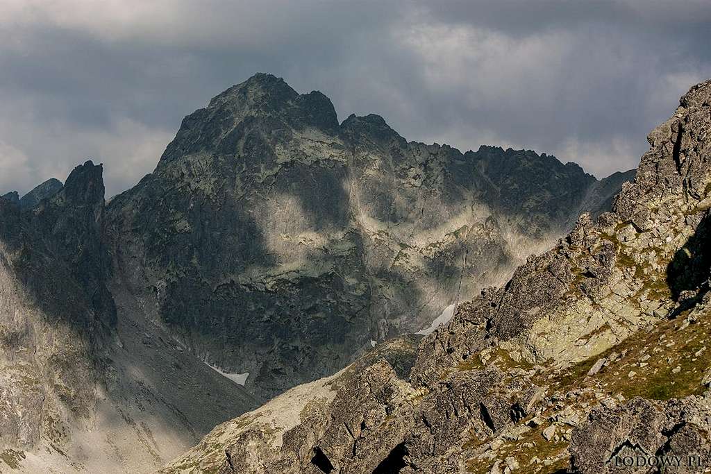
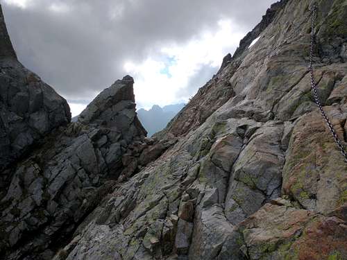
The via normale from Priečne sedlo is a UIAA grade I/YDS class 3-4 route. The route via the main ridge from Sedielko is more demanding and exposed. I haven't done it but from what I read its rock difficulty is one level up. Although the best-looking face of Široká veža may be its northeast side, it is its 200m-high south face that is especially interesting from the technical climber’s perspective. It has several routes rated from grade IV to VIII- on the UIAA scale and is readily accessible from the waymarked hiking trail (yellow marks). 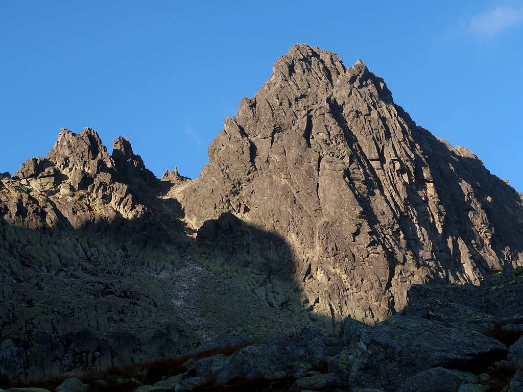
|
Summit Views
|
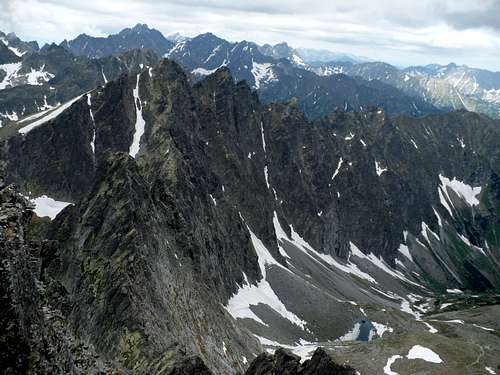
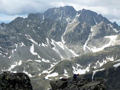
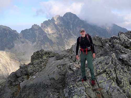
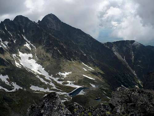
The summit of Široká veža is a superb vantage point, which offers views of several highest Tatra peaks and a stunning view of Prostredný hrot. 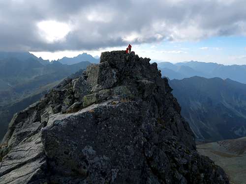
|
Maps
As for the analog maps, there are plenty of options. I would recommend the plastic 1:25,000 map of the Polish and Slovak Tatras by WiT. It is waterproof, durable and cheap. |
Getting There & Accommodation
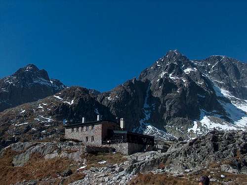
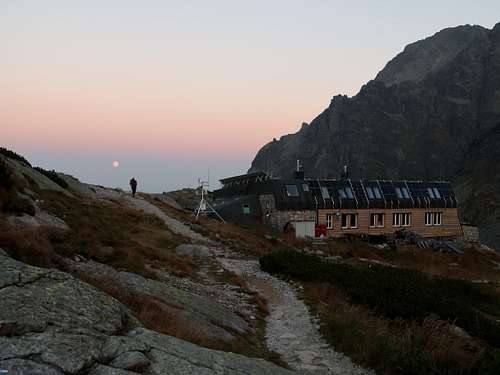
The mountain huts located near Široká veža are Téryho chata at 2015m in the upper part of the Malá Studená dolina (Little Cold Valley) and Zbojnícka chata at 1960m in the upper part of the Veľká Studená dolina (Great Cold Valley). The huts are connected by a waymarked hiking trail (yellow marks) which runs through the upper col of Priečne sedlo. The following table shows key statistics for the routes to this col.
From the upper col of Priečne sedlo it takes you about forty minutes to get to the summit of Široká veža, which lies 153m higher than the col. (The upper col has an elevation of 2309m, the lower col is at 2305m.) 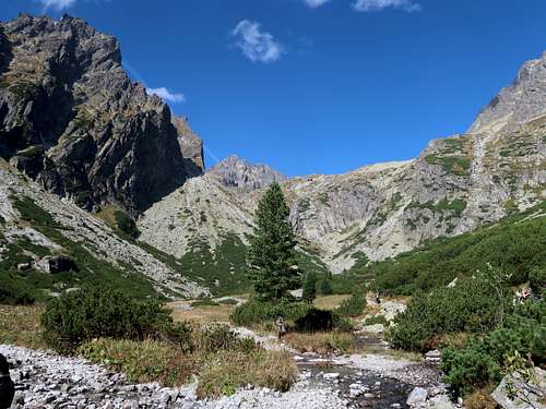
As far as accommodation is concerned, there are plenty of options outside the Tatras, many of which can be found on the Internet. Those in the town of Vysoké Tatry are rather expensive. Reasonable offers can be found just a bit farther away in settlements such as Nová Lesná (frequent trains from dawn to 11 pm!), Stará Lesná or the still quaint village of Ždiar. |

Red Tape
HikingYou must keep to the waymarked trails. Bivouacking is not permitted. You are not supposed to hike during the night. The trails above huts are closed for hikers from 1 November to 15 June. 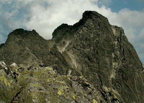
Rock ClimbingYou must be a member of a rock climbing club. Just before your climb, you should write it into the register kept in a nearby mountain hut/your hotel. (Make sure you sign it on return too!) During the approach you must stick to the traditionally used routes described in rock climbing guidebooks. Bivouacking on the wall is only allowed in an emergency. Except for winter, you must not do a route that is easier than UIAA grade III (approx. YDS grade 5.3) unless on the descent. The funny thing is that the last rule does not apply to those hiking/scrambling with a licensed guide whom they have paid €200-300 for looking after them. 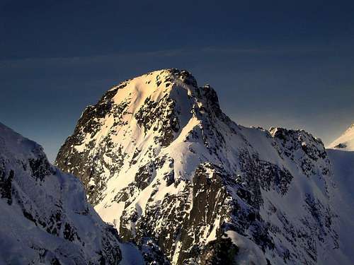
|
Mountain Conditions, Rescue & Warnings
|
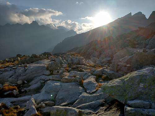
The best season to go is summer and often early autumn, the best month seems to be September providing it isn't rainy. In high season and at weekends expect crowds on the approach trails. 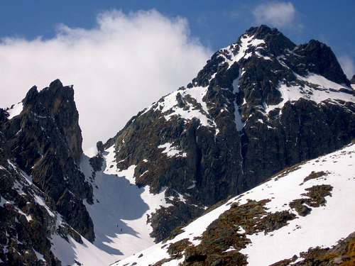
|