
|
|
Mountain/Rock |
|---|---|
|
|
37.28881°N / 106.77414°W |
|
|
Download GPX » View Route on Map |
|
|
Mountaineering |
|
|
Summer |
|
|
12500 ft / 3810 m |
|
|
Overview
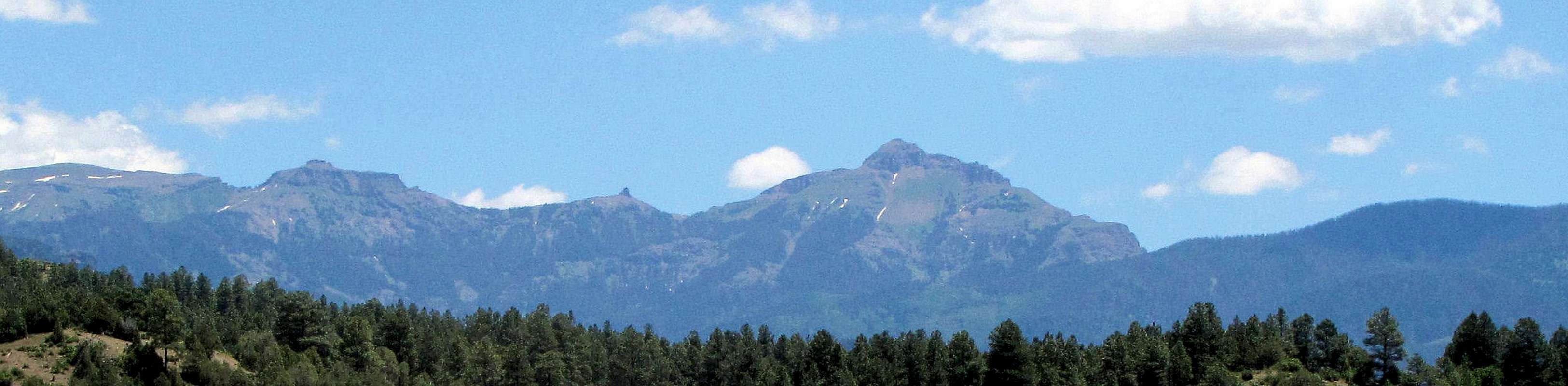
Right to left: Blackhead Peak 12500 ft, Nipple Mountain 12060 ft and Point 12260 ft, west face
Blackhead is a rugged peak that rises to the east of the town of Pagosa Springs in the San Juan Mountains of southwestern Colorado. A band of cliffs guards the upper parts of Blackhead Peak. An opening in the cliffs on the north side of the peak, allows access to the uppers parts. Once you go above the cliffs, you will find yourself on a large sloped grassy area that leads you to the summit.
An abandoned dirt road takes you to an elevation of 10350 ft at the western base of Blackhead Peak. You can then follow a beaten path up the forest, by a spectacular waterfall to reach the saddle between Blackhead Peak and Nipple Mountain where you can go through the opening in the cliffs to reach the top.
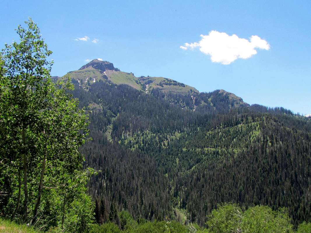
West face of Blackhead Peak
Getting There
From the junctions of Route 160 and 84 to the east of Pagosa Springs, CO, turn south onto Route 84. After a very short distance, turn east onto the first dirt road known as Mill Creek Road. Basically drive this road around 16 miles to the end of it. Different maps, give the road different names or numbers. The upper parts of the road are known as Nipple Mountain Road. It starts at road number 302 then becomes 662 and finally 665/24. Near the end of the road, you will see a signed trailhead. This is not Blackhead Peak Trailhead. Drive a short distance beyond this trailhead to where the road is blocked. I drove an all wheel drive vehicle. My guess is that in dry conditions, any vehicle can drive this road. Only during the last 2-3 miles, the road surface came to be covered with stones becoming somewhat rough.Route
All distances are per my GPSStart hiking the road (which is closed to vehicles but open to hikers) going toward Blackhead Peak. Nipple Mountain will also be visible.
 Blackhead & Nipple
Go beyond where a creek has washed out the road. Right after crossing another creek at 1.20 miles from start of the hike (see map above), you will have to leave the road and go up the slopes. I actually found a beaten path that took me all the way to the saddle between Blackhead Peak & Nipple Mountain. This path was at times faint but if you know where you need to go, you can find your way. Follow the trail into a forest. It goes up the slopes steeply.
 |
 |

A waterfall comes to view with the summit of Blackhead looming above it.
 Waterfall Waterfall |
 Waterfall Waterfall |
Farther up.
 Summit of Blackhead Summit of Blackhead |
 |

As you reach the saddle, Nipple Mountain comes to view.
 Nipple Mounatin Nipple Mounatin |
 Nipple Mountain Nipple Mountain |
Views to the north and west from the saddle.
 Summit Peak Summit Peak |
 12ers to the west 12ers to the west |
At the saddle, you should turn south and follow the ridgetop to the summit. I actually followed the trail on the right (west side) below some cliffs (not on the ridgetop)bypassing them until I reached a grassy area where the opening in the cliffs appeared. The opening was somewhat steep and loose but nothing technical.
 Opening in the cliffs Opening in the cliffs |
 Cliffs Cliffs |
Once you go above the cliffs, you will find yourself on a big grassy plateau. Summit can now be easily reached.
 Summit of Blackhead Summit of Blackhead |
 Grassy area Grassy area |
Views from the summit.
 Squaretop Mountain Squaretop Mountain |
 Looking west Looking west |
 Looking southeast Looking southeast |
 Montezuma & Summit Peaks Montezuma & Summit Peaks |
 Sand & Nipple Mountains Sand & Nipple Mountains |
 Basin to the west Basin to the west |
 Coal Mountain and the dirt road Coal Mountain and the dirt road |
 Pagosa Peak, zoomed view Pagosa Peak, zoomed view |