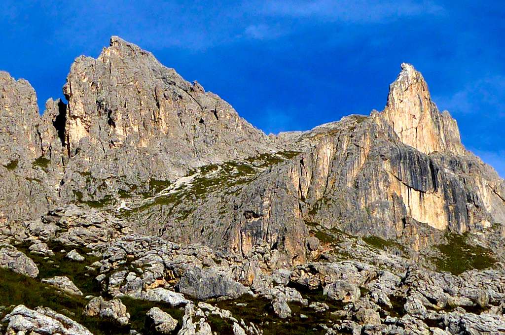
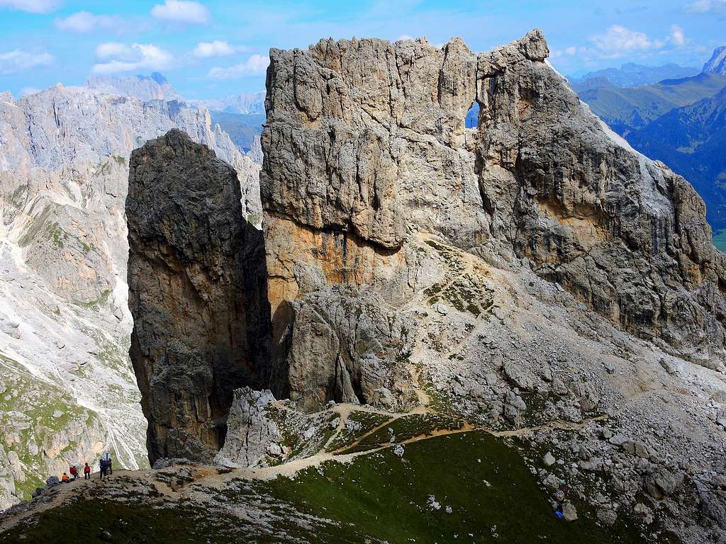
Croz di Santa GiulianaA curious rock, Croz di S. Giuliana or Torre Finestra
Croz di Santa Giuliana 2670 m is a singular and characteristic yellow coloured tower located in the subgroup of Vael, Catinaccio Group, near the Rifugio Roda di Vael, to the East of the slope between Roda di Vaél and Roda del Diavolo. The peak shows a huge hole about 4 meters wide, just below the summit, which is the reason it is also called Torre Finestra (Window Tower) or Fensterl-Turm in German.
It’s well known to the climbers in reason of its particular look – showing very different shapes depending on the side from which you observe - and its fine and popular climbing routes.
Roda del Diavolo and Croz di Santa Giuliana (aka Torre Finestra)
Getting There
Road access
From Bolzano take the Val d’Ega road, reach Nova Levante, the beautiful Carezza Lake and the Costalunga Pass m. 1753. From here take the path 548 to the Roda di Vaèl Hut m. 2283 (1,30 hours). Otherwise, more shortly, it’s also possible to use the chair lift - starting below the pass - to the refuge Paolina and hence reach the Roda di Vaèl Hut or Rotwandhütte through the path 539 (0,40).
Another view of Croz di S.ta GiulianaRapping from Croz di S.ta Giuliana
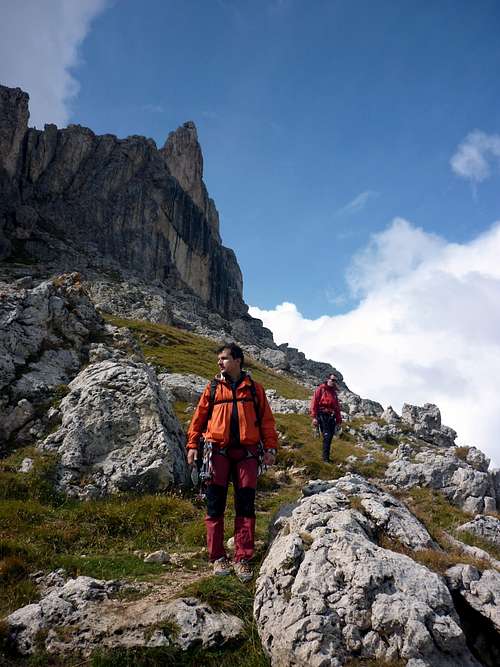
Access to Croz di Santa Giuliana from Roda di Vaèl Hut
Above the shelter take the path to the Ferrata Masaré (signposts Torre Finestra). At first the path rises along meadows, then, when the trail comes close to the base of the Croz di Santa Giuliana, you will find some fixed ropes and finally a characteristic ladder that enters a narrow tunnel. At the exit, you find yourself at the base of a large grassy basin. At a crossroads take the path uphill, passing just below the Croz di Santa Giuliana. Just below the base of the Croz, leave the main path, heading to a pair of plates, one of which is white visible from afar.
Croz di S.ta Giuliana or Torre Finestra
Routes
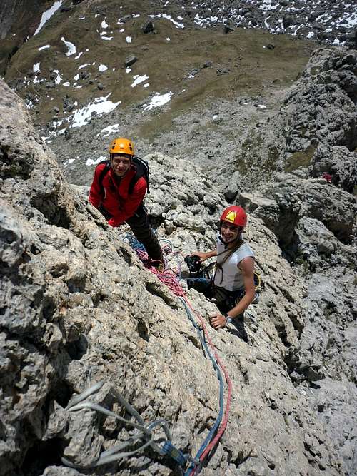
There are several routes, but the two most climbed ones are the short Normal route and the classic South Ridge.
* Normal Route on West face II, 70 m. A good short route to reach the summit, suitable for beginners
* South Ridge III, a short move graded IV, 130 m. Another nice and exposed climb, more difficult than the previous one, on excellent rock - A collapse has recently affected the Southern ridge of the Croz di Santa Giuliana. The climb requires particular caution.
* Eisenstecken (East Face) VI+, 80 m. A short but challenging route
* Millo-Tarter (East Face) VI-, 70 m.
Croz di S.ta Giuliana
South ridge-
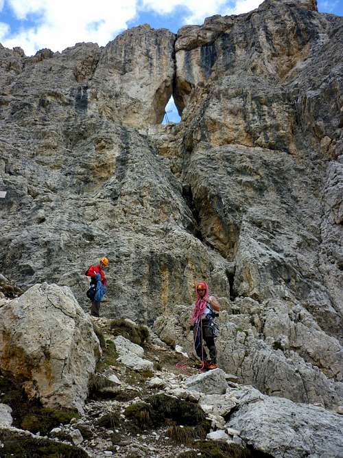
Guys at the bottom of the abseil line
Approach to Normal Route - From Rifugio Roda de Vael take the path to Ferrata del Masarè (signpost Torre Finestra). At first the path rises along meadows, then, when the trail comes close to the base of the Croz di Santa Giuliana, you will find some fixed ropes and finally a characteristic ladder that enters a narrow tunnel. At the exit, you find yourself at the base of a large grassy basin. At a crossroads take the path uphill, passing just below the Croz di Santa Giuliana. Just below the base of the Croz, leave the main the path, heading to a pair of plates, one of which is white visible from afar. The attack is to the right of the plates.
The hole of Croz di Santa Giuliana
Approach to South Ridge - Same approach as for the previous route, but continue to the right to find the base of the ridge located to the right of the Normal route.
Rapping near the huge windowMeadows along the descent
Descent: from the summit head towards South, reaching an anchor from where the first rappel starts (20 m). You pass just in front of the window and just below, on a balcony, there is a single peg to make the subsequent rappel (18 m), that settles on the attack.
Red Tape
Croz di Santa Giuliana map
No fees and no permits required. Croz di Santa Giuliana and the entire Catinaccio Group is situated in the Natural Park Sciliar-Catinaccio- Latemar, a park located inside one of the 9 areas of the Dolomites approved in the UNESCO natural sites. More info In this article bySilvia Mazzanimore info about Dolomites UNESCO World Heritage Site:Dolomites, living mountains
Access: from Costalunga Pass via the path 548, from Rifugio Paolina via the paths 539 and 549, from Refuge Ciampedie via the path 545, from Vigo di Fassa via the paths 547 and 545.
* Rifugio Pederiva Access. see the previous hut
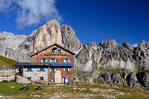
* Rifugio Paolina m 2125 Access: by chair lift from Karer Lake 1620 m. or by walk from Costalunga Pass
Surroundings
The Vaèl Subgroup counts several towers of "dolomia", the typical rock of the Dolomites. The most famous peaks are Roda di Vaèl and Mugoni, lying just in the surroundings of Croz di Santa Giuliana, which are both legendary peaks where some of the most important pages of the climbing history in the Dolomites had been written.
The beautiful MugoniRoda di Vael and SforcellaSforcella - Tscheiner SpitzeAt sunrise
When to Climb
The best season is summer (from the end of June to the end of September)
Bibliography
* “La nuova guida del Catinaccio” by Antonio Bernard, Ed. Mediterranee, 2008 * “Catinaccio” by Dante Colli and Gino Battisti, Tamari Editori in Bologna, 1984 * Map TABACCO n. 06 - Val di Fassa e Dolomiti fassane
Parents refers to a larger category under which an object falls. For example, theAconcagua mountain page has the 'Aconcagua Group' and the 'Seven Summits' asparents and is a parent itself to many routes, photos, and Trip Reports.


 and Tscheiner Spitze")

