
|
|
Mountain/Rock |
|---|---|
|
|
59.18756°N / 135.38394°W |
|
|
Haines |
|
|
Hiking, Skiing |
|
|
Summer |
|
|
1760 ft / 536 m |
|
|
Overview
Mount Riley is the highest point on the Chilkat Peninsula just south of Haines Alaska. The peak has been rounded down by glaciers and doesn’t rise above timberline, but on a clear day the views are fantastic. The rugged Cathedral Spires are to the west, the Takshanuk Mountains to the north, and the very jagged Coast Range to the east. The forest on Mount Riley is beautiful as well and the mountain rises directly from the coast on both the east and west sides.
We were not able to climb Mount Riley on a clear day and the cloud ceiling was rather low, but much of the views of the surrounding mountains are similar to those from Shakuseyi Peak and Mount Ripinski, so you can view the photos on those pages for a good idea of what the surrounding mountains look like.
The peak has easy access and climbing Mount Riley is well worth the effort and has a high effort to reward ratio.
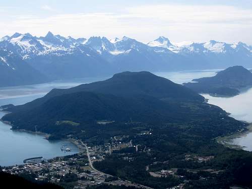
Mount Riley is the forested peak in the foreground. In the far background are the jagged peaks of the Coast Range. Mt Sinclair is the prominent sharpy towards the left. Haines is seen below. As viewed from Mount Ripinski.
Getting To Haines, Alaska
The first destination is Haines Alaska, which can be reached by road, plane or by ferry. If coming from places like the lower 48 states, the most economical way to get to Haines would be to fly to Juneau and take the ferry from there. No buses serve Haines, but you can take a bus to Skagway and then take the ferry from there.
Getting to Haines via Road, Plane or Ferry is a very scenic trip in itself, at least when the weather is good.
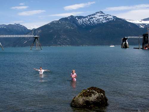
Kessler and Shaylee in Haines Alaska.
Getting to Haines
By Road
Haines is accessible by road from the Alcan Highway from Haines Junction, Yukon Territory. The highway is designated 3 on the Yukon side and SH7 on the Alaska side. The highway is 152 miles long (about 3.5 hours) and is a very scenic drive.
By Plane
Wings of Alaska has flight to Haines from both Skagway and Juneau.
By Ferry
The Alaska Marine Highway System has ferries from both Juneau (3.5 hours) and Skagway (one hour) and is a relatively economical way to travel. The ferry terminal is north of town and a shuttle taxi service meets incoming ferries.
Part of the Alaska Marine Highway between Juneau and Haines Alaska.
The Haines-Skagway Fast Ferry has service to Haines from Skagway (35 minutes). This one drops you off right in Haines, so it’s a good service to use.
Looking out over the Chilkoot Inlet from the slopes of Mount Ripinski. The Haines-Skagway Fast Ferry can been seen below.
Getting to the Trailheads
Mud Bay Road Trailhead
This trailhead offers a very direct route to Mount Riley.
From Main Street in Haines, head south on Third Avenue, which becomes Mud Bay Road as soon as you leave town. After about 0.8 miles from Main Street, turn right on the road posted for Chilkat State Park. Follow the road to a sign for the Mount Riley Trail. This is about three miles from Main Street in Haines.
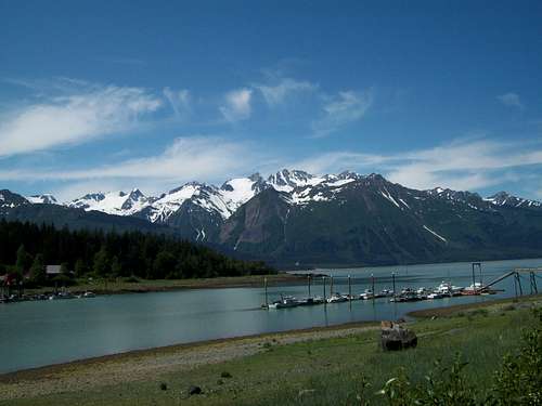
Photo taken near the Mud Bay Road Trailhead.
Beach Road/Battery Point Trailhead
This trailhead offers what is probably the most scenic route up Mount Riley. From Main Street in Haines, head south on Third Avenue and turn left on the Haines Highway. Follow the highway east and south (the name of the highway will change to Beach Road) and follow the road to its end. This is about two miles from Main Street in Haines.
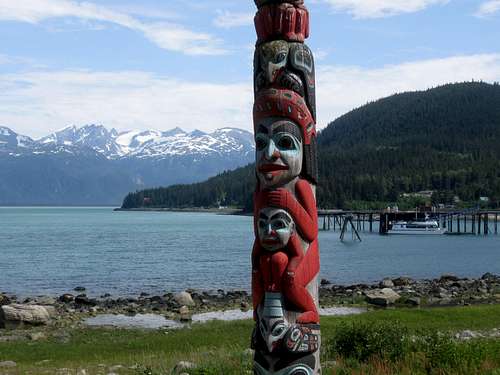
Mount Riley (right) and a totum pole as viewed from Haines. The Beach Road/Battery Point Trailhead is near the left side of the forested point.
Lily Lake/FAA Road Trailhead
The FAA Road to Lily Lake begins at Officers Row at the south end of Fort Seward, which is the southern part of Haines. The road to Lily Lake is closed one mile from Officers Row to where it continues another two miles to Lily Lake.
Routes Overview
For a small mountain, Mount Riley offers a variety of routes from several directions. Which route is best to take will depend on your time and mode of transportation as well as your choice of accommodation.
Since we were staying at the Bear Creek Cabins on the west side of Chilkat Peninsula and did not have a vehicle, we took a taxi (well worth it) to the Beach Road/Battery Point Trailhead on the east side of the peninsula, climbed the peak and descended the Mount Riley Trail to Mud Bay Road where we walked back to the Bear Creek Cabins.
If you are staying at say the Portage Cove Campground, you may prefer an out and back climb from the Beach Road/Battery Point Trailhead. If you are staying in downtown Haines without a vehicle, the best route is probably to walk to the Beach Road/Battery Point Trailhead and hike back to Haines via Lily Lake and the FAA Road. This will eliminate the three mile paved road walk from Mud Bay.
If you have your own car and don’t want to mess with a shuttle, hitchhiking or taxi, the recommended route to Mount Riley is from Beach Road/Battery Point.
Mount Riley Trail via Mud Bay Road
This is a short route climbing to Mount Riley along a well constructed trail. The one way distance is 2.8 miles.
See the route page for details.
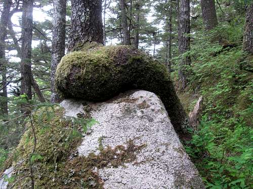
Tree seen on the route to Mount Riley.
Mount Riley via Beach Road/Battery Point
Though it is the longest of the normal routes, this is the most scenic of the trails to the summit of Mount Riley. It is 4.0 miles each way and offers a nice side trip to Battery Point.
See the route page for details.
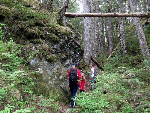
Part of the trail from Battery Point to Mount Riley.
Lily Lake/FAA Road Trailhead
This route follows the closed Lily Lake Road for 2.0 miles before climbing another 1.5 miles to the summit of Mount Riley. If you are traveling without a vehicle, this makes a convenient descent route back to Haines from the summit.
Red Tape
No motorized vehicles are allowed on the trail.
Camping
There are three places to camp around Haines.
Portage Cove is on Beach Road (east side of Chilkat Peninsula 0.5 miles southeast of Fort Seward (which is the southeastern part of Haines). This campground about a mile from the Beach Road/Battery Point Trailhead.
Chilkat State Park is seven miles south of Haines along Mud Bay Road (west side of Chilkat Peninsula).
Bear Creek Cabins and Hostel also allows camping and is the least expensive place to stay without a tent as well. It’s a nice place and is where we stayed. It is fairly close to the Mud Bay Trailhead.
When to Climb
June through September is the normal hiking season. With easy access, winter ascents would be reasonable as well and avalanche danger should be low.
June can be a really nice time to climb (and is probably the ideal month for this climb) since it’s the sunniest summer month and tourist season isn’t quite in full swing yet. July is excellent too while August and September are wetter and cloudier. Fall and winter tend to be quite wet. Snow can persist on parts of the mountain into June, but early season ascents with good footwear would be rewarding.
Winters are much milder here than in interior Alaska.
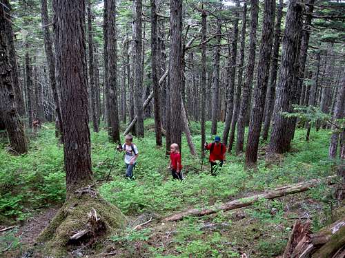
Deep in the forest on the lower slopes of Mount Riley on a cloudy June day.
Mountain Conditions
Weather Forecast for Mount Riley
Below is the National Weather Service Climate Summary of Haines. The data is from 1926-2018. This is the closest long term weather station. Haines is close sea level and temperatures on this mountain are probably only about 5 degrees colder than in Haines.
| MONTH | AVE HIGH | AVE LOW | REC HIGH | REC LOW | AVE PREC (in) |
| JAN | 30 | 20 | 57 | -13 | 5.13 |
| FEB | 34 | 23 | 53 | -16 | 4.21 |
| MAR | 39 | 27 | 63 | -7 | 3.33 |
| APR | 49 | 34 | 75 | 6 | 2.57 |
| MAY | 58 | 42 | 83 | 26 | 1.76 |
| JUN | 64 | 49 | 92 | 30 | 1.45 |
| JUL | 65 | 51 | 90 | 35 | 1.52 |
| AUG | 65 | 50 | 89 | 32 | 2.55 |
| SEP | 57 | 44 | 86 | 24 | 5.36 |
| OCT | 47 | 37 | 65 | 6 | 8.69 |
| NOV | 36 | 26 | 58 | -11 | 6.27 |
| DEC | 32 | 22 | 57 | -14 | 5.64 |